
:::: MENU ::::
TOP

Posts Categorized / News


( ! ) Warning: Trying to access array offset on null in /var/www/html/wp-site/wp-content/themes/fizz/category-news.php on line 75
Call Stack
#TimeMemoryFunctionLocation
10.0011458600{main}( ).../index.php:0
20.0013458952require( '/var/www/html/wp-site/wp-blog-header.php ).../index.php:17
30.12525010416require_once( '/var/www/html/wp-site/wp-includes/template-loader.php ).../wp-blog-header.php:19
40.12755036376include( '/var/www/html/wp-site/wp-content/themes/fizz/category-news.php ).../template-loader.php:132


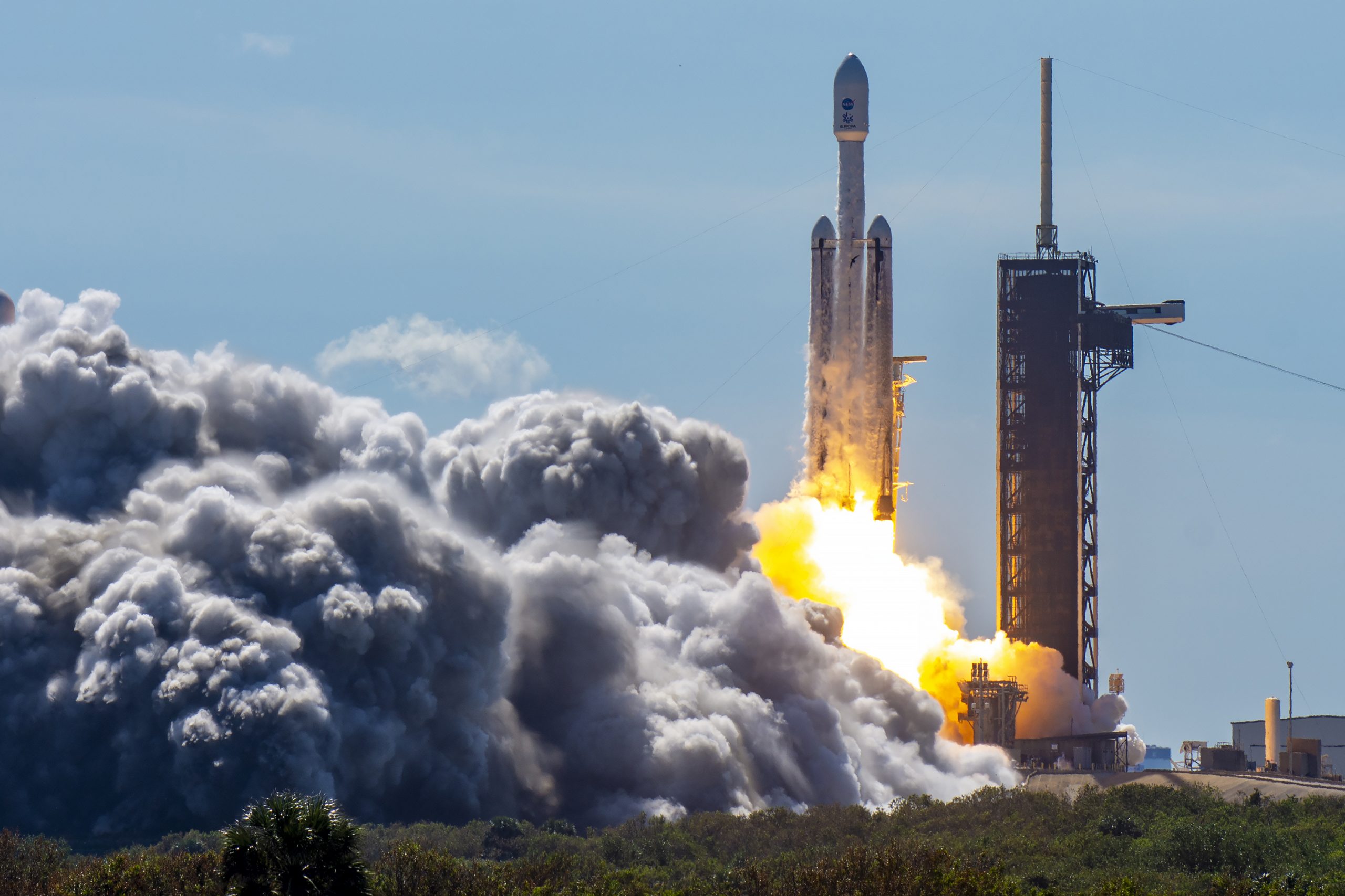
Europa Clipper mission has launched on October 14th, 2024, toward the Jupiter moon Europa.

RSLab is part of the team of REASON (Radar for Europa Assessment and Sounding: Ocean to Near-surface), which is one of the main instruments on-board Europa Clipper. REASON is designed for probing Europa’s icy shell for the moon’s suspected ocean and studying the ice’s structure and thickness. The data acquired by REASON together with the data taken by RIME (Radar for Icy Mooon Exploration, under the RSLab leadership) on-board the ESA JUICE (Jupiter Icy Moons Explorer) spacecraft (currently in cruise toward the Jupiter system) will contribute to discover the subsurface world of the Jupiter icy moons, which is stimulating the imagination of scientists and science fiction since very long time.

The two radars, REASON and RIME, were conceived in the phase in which Juice and Europa Clipper were part of the joint EJSM mission (Europa Jupiter System Mission) which envisaged a close collaboration between ESA and NASA for the synergistic development of two probes, one from send into orbit around Ganymede (ESA’s) and the other around Europa (NASA’s). For programmatic reasons the joint mission was then separated into the two independent missions Europa Clipper and Juice, but the collaboration continued to optimize the complementarities and differences of the two radars and the related scientific objectives. With the launch of Europa Clipper, which follows that of Juice, the initial plan to have two probes dedicated to the study of Jupiter’s icy moons is effectively realized and completed.

Go Europa Clipper!

Image credits: NASA

Below some samples from the coverage of the regional and national media.


( ! ) Warning: Trying to access array offset on null in /var/www/html/wp-site/wp-content/themes/fizz/category-news.php on line 75
Call Stack
#TimeMemoryFunctionLocation
10.0011458600{main}( ).../index.php:0
20.0013458952require( '/var/www/html/wp-site/wp-blog-header.php ).../index.php:17
30.12525010416require_once( '/var/www/html/wp-site/wp-includes/template-loader.php ).../wp-blog-header.php:19
40.12755036376include( '/var/www/html/wp-site/wp-content/themes/fizz/category-news.php ).../template-loader.php:132

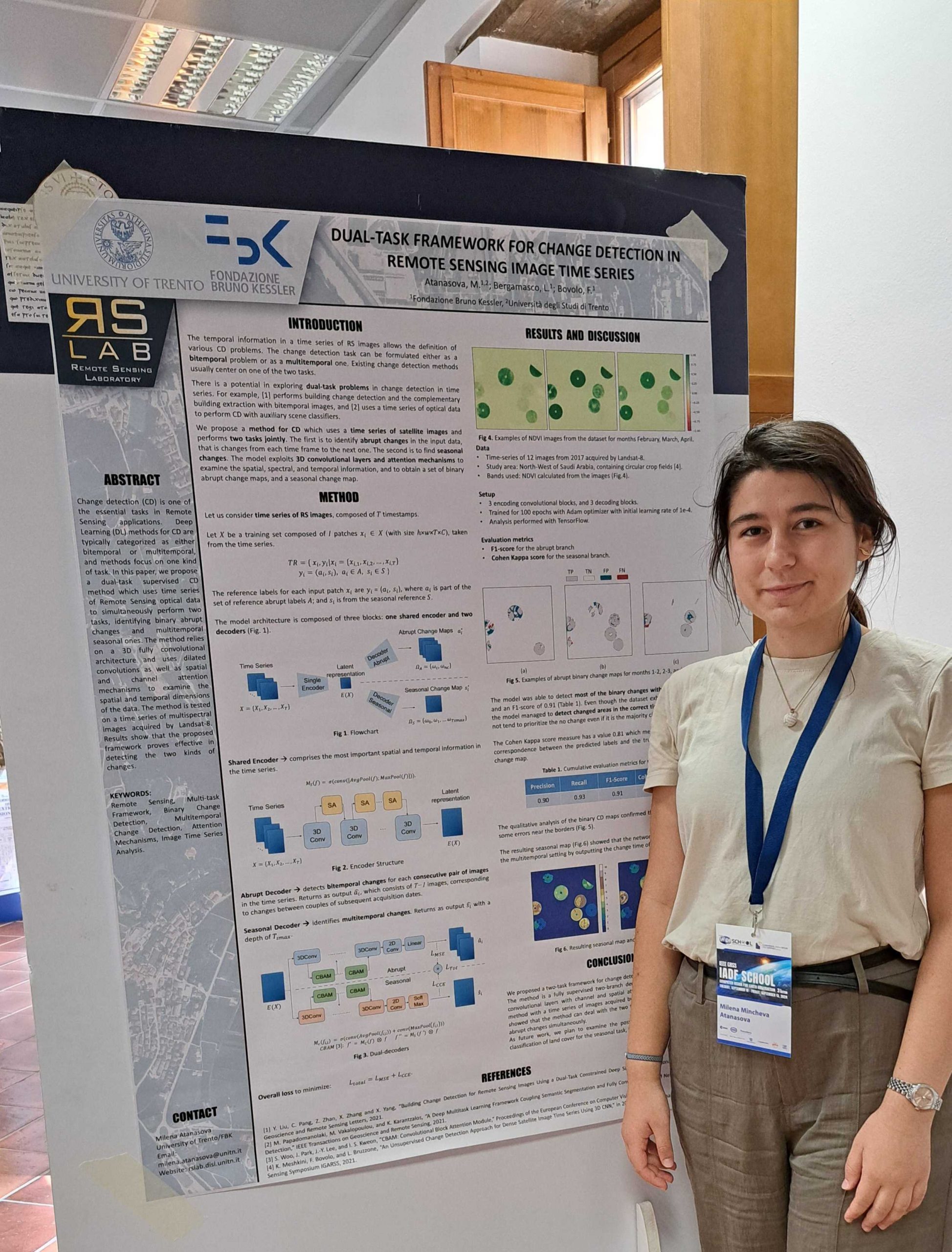
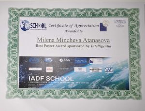
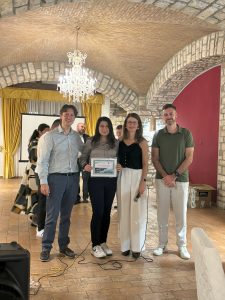
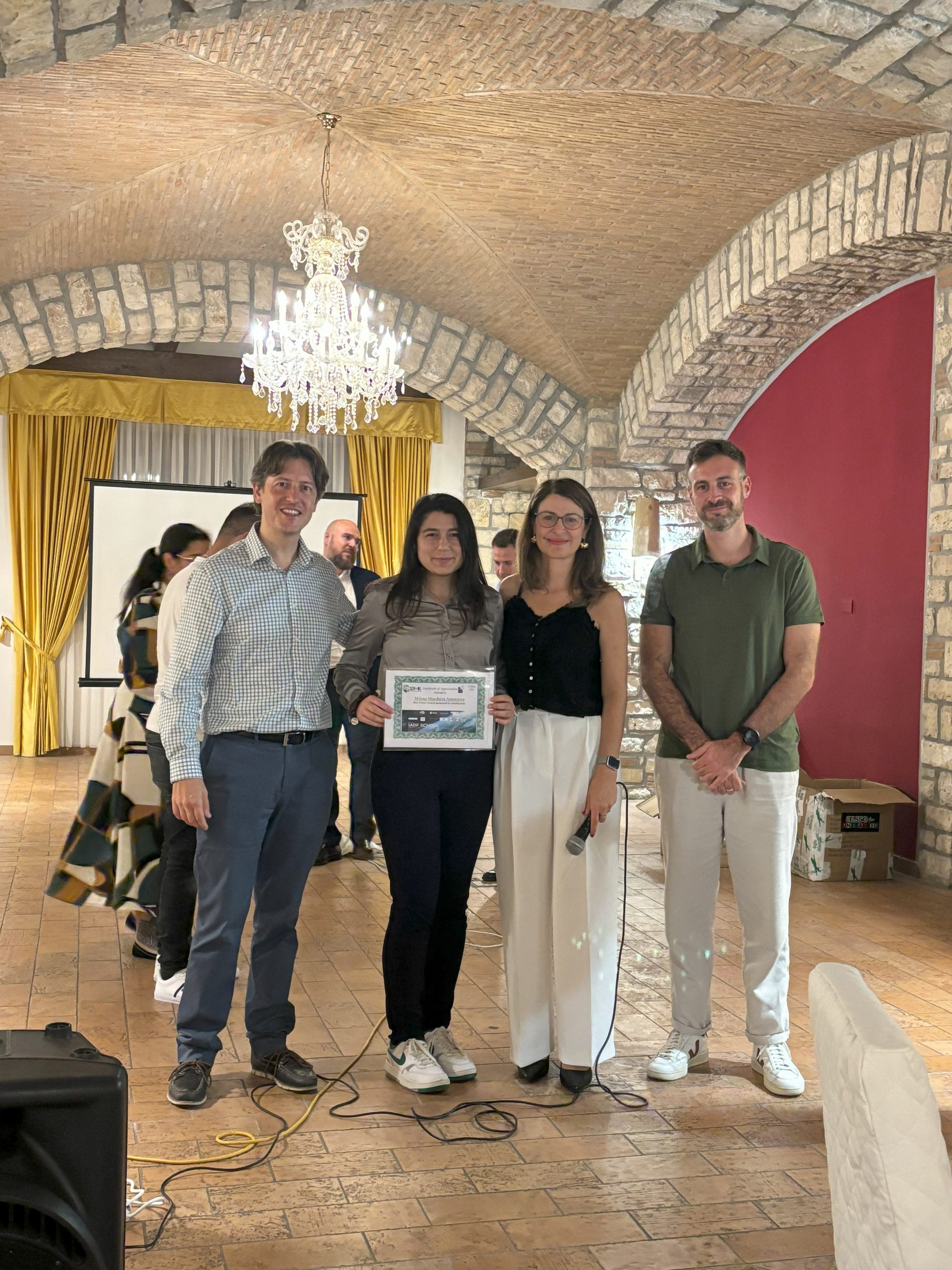
Congratulations to Milena Atanasova for receiving the Best Poster Awards at IEE Geoscience and Remote Sensing Society (GRSS) IADF Summer School on Computer Vision for Earth Observation in Benevento, Italy.

More information about the summer school at the link: https://iadf-school.org/


( ! ) Warning: Trying to access array offset on null in /var/www/html/wp-site/wp-content/themes/fizz/category-news.php on line 75
Call Stack
#TimeMemoryFunctionLocation
10.0011458600{main}( ).../index.php:0
20.0013458952require( '/var/www/html/wp-site/wp-blog-header.php ).../index.php:17
30.12525010416require_once( '/var/www/html/wp-site/wp-includes/template-loader.php ).../wp-blog-header.php:19
40.12755036376include( '/var/www/html/wp-site/wp-content/themes/fizz/category-news.php ).../template-loader.php:132

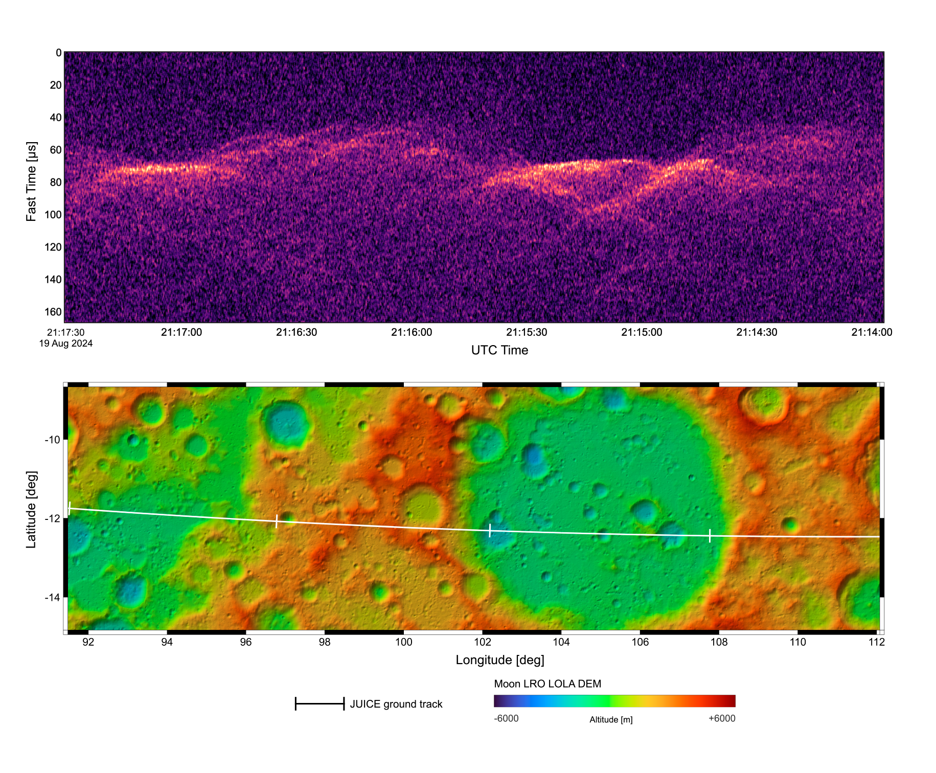
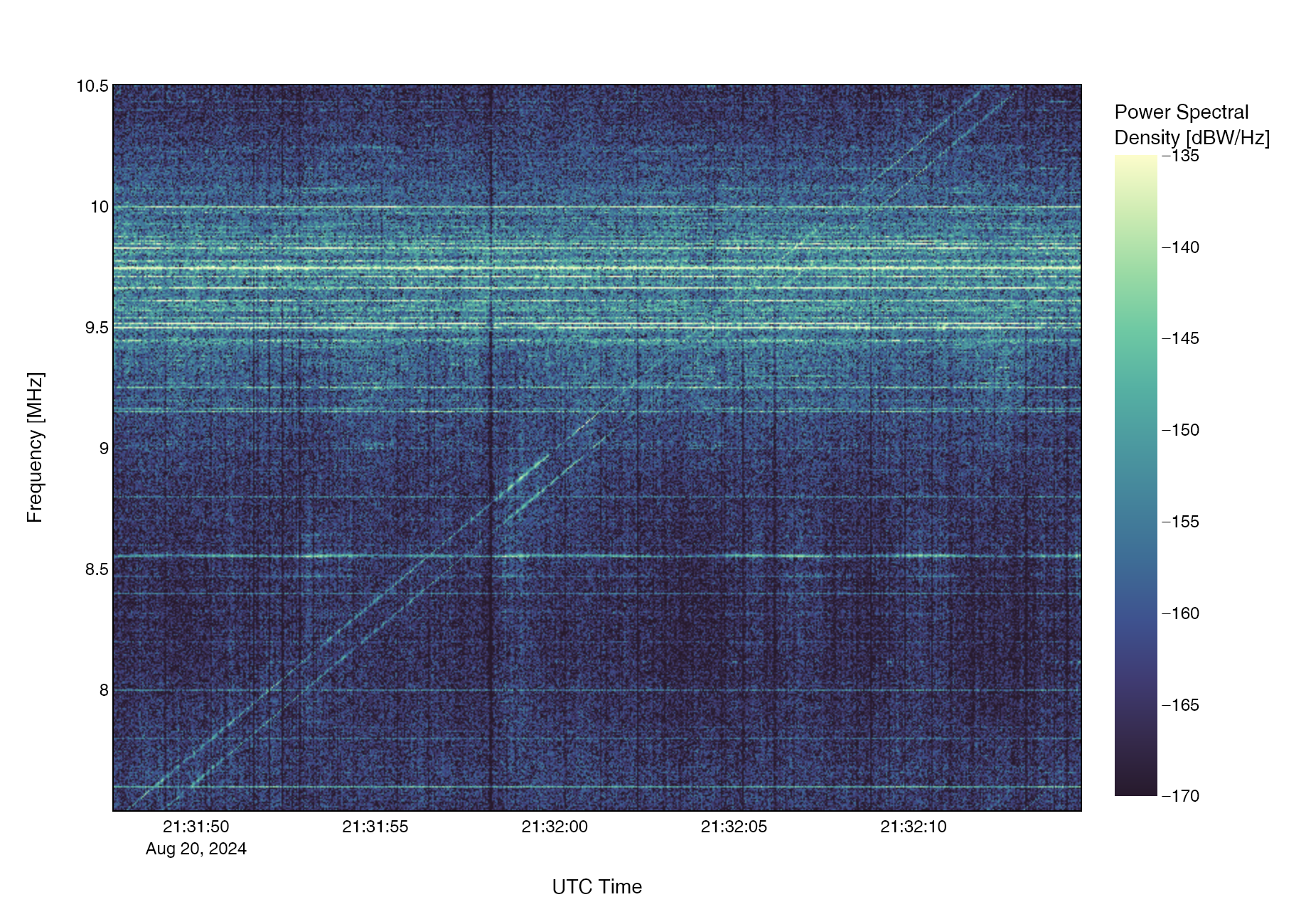
On August 19-20, JUICE successfully completed the world’s first Lunar-Earth gravity assist. This maneuver will allow JUICE to take a shortcut via Venus on its route to the Jupiter system.

During the flybys of the Moon on August 19 and Earth on August 20, RIME was operating and successfully acquired data on both celestial bodies. Our team at the RIME Science Operation Centre of RSLab at the University of Trento monitored RIME’s telemetry during operations and is currently analyzing the data collected during this complex maneuver.

Below some samples from the coverage of the regional, national and international media.


( ! ) Warning: Trying to access array offset on null in /var/www/html/wp-site/wp-content/themes/fizz/category-news.php on line 75
Call Stack
#TimeMemoryFunctionLocation
10.0011458600{main}( ).../index.php:0
20.0013458952require( '/var/www/html/wp-site/wp-blog-header.php ).../index.php:17
30.12525010416require_once( '/var/www/html/wp-site/wp-includes/template-loader.php ).../wp-blog-header.php:19
40.12755036376include( '/var/www/html/wp-site/wp-content/themes/fizz/category-news.php ).../template-loader.php:132

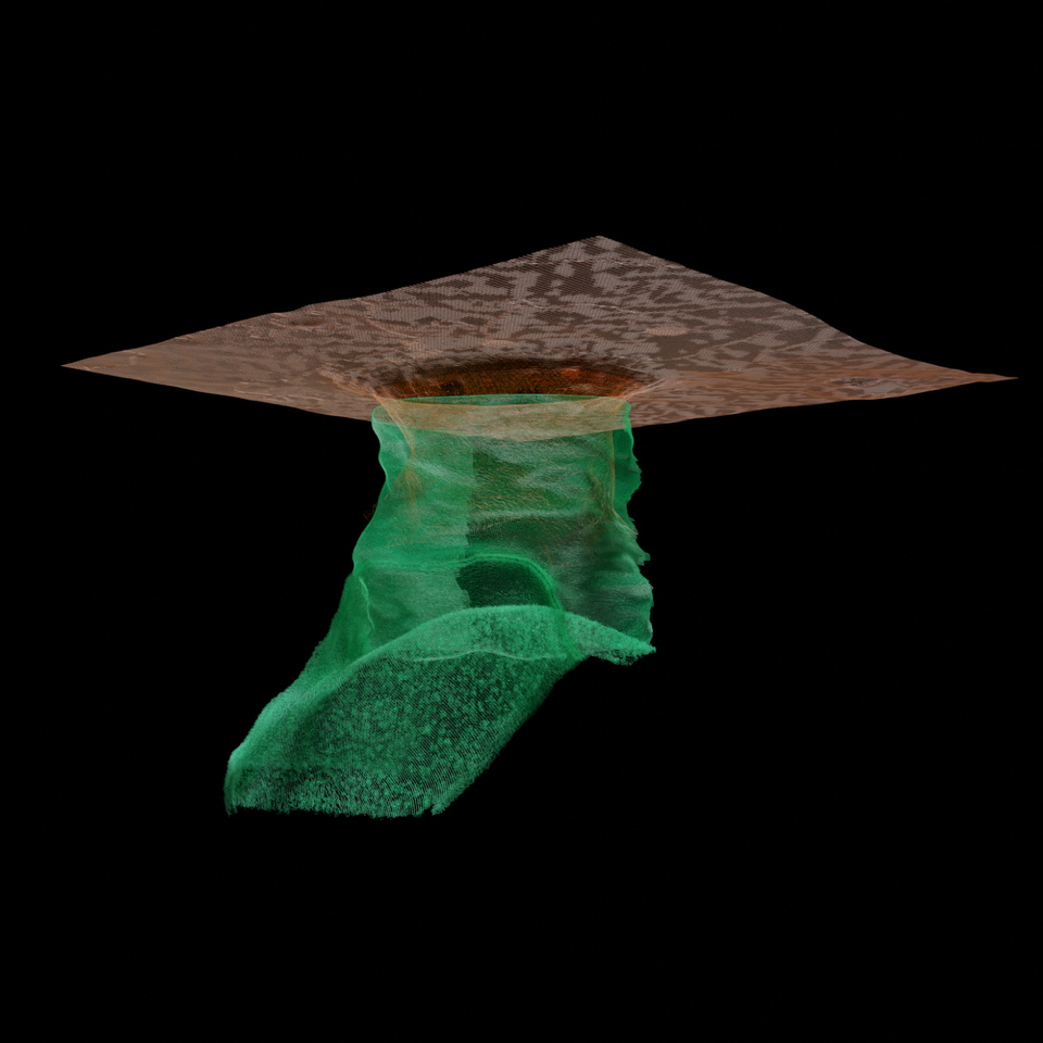
Nature has selected one of the images of the recent paper on lunar cave discovery published on Nature Astronomy under the coordination of RSLab in the ‘Images of the Month’ for July 2024. This prestigious achievement is related to an image of the paper that shows a 3D reconstructionsof the entrance of the cave as derived from the analysis of NASA LRO radar data and the related geological modeling. You can find the image and the related details here.

In general the paper has generated a very large attention from the media worldwide (more than 690  news outlets  according to Nature) with also funny appearence into a very popular American comedy show with Stephen Colbert (see at minute 3:50)

Below some other links to selected recent media publication (see also the news published on July 16th for many others).

Credits: the surface topography part of the image has been taken by ROC NAC data (Wagner, R. v., & Robinson, M. S. (2022). Lunar Pit Morphology: Implications for Exploration. Journal of Geophysical Research: Planets, 127(8). 


( ! ) Warning: Trying to access array offset on null in /var/www/html/wp-site/wp-content/themes/fizz/category-news.php on line 75
Call Stack
#TimeMemoryFunctionLocation
10.0011458600{main}( ).../index.php:0
20.0013458952require( '/var/www/html/wp-site/wp-blog-header.php ).../index.php:17
30.12525010416require_once( '/var/www/html/wp-site/wp-includes/template-loader.php ).../wp-blog-header.php:19
40.12755036376include( '/var/www/html/wp-site/wp-content/themes/fizz/category-news.php ).../template-loader.php:132

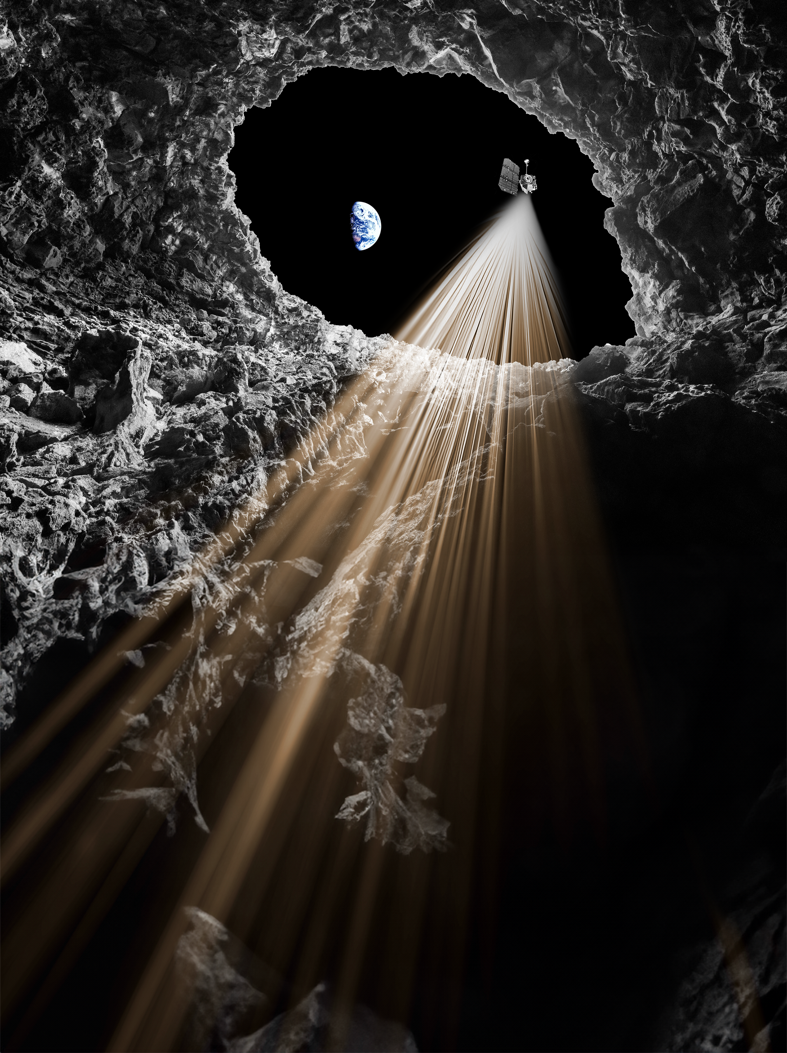
A study, under the leadership of RSLab, has proven for the first time the existance of an accessible conduit at the bottom of a lunar Pit in the Tranbquility Sea. This has been possible by re-analayzing a synthetic aperture radar image acquired in 2010 by the Lunar Reconnaissance Orbiter of NASA with a new radar processing technology recently developed at RSLab. The study has very important scientific implications and is very relevant for shaping future exploration acitvities on the Moon.

The paper is available at this link.

The research has worlwide resonance with a huge attention from the media of all the world. Below some selected example of media coverage with dedicated interviews on the discovery.


Credits: Artist’s impression of an underground cave on the Moon. Credit: Elaboration of a photo by A. Romeo. LRO
3D model by NASA (Brian Kumanchik, Christian Lopez, NASA/JPL-Caltech


( ! ) Warning: Trying to access array offset on null in /var/www/html/wp-site/wp-content/themes/fizz/category-news.php on line 75
Call Stack
#TimeMemoryFunctionLocation
10.0011458600{main}( ).../index.php:0
20.0013458952require( '/var/www/html/wp-site/wp-blog-header.php ).../index.php:17
30.12525010416require_once( '/var/www/html/wp-site/wp-includes/template-loader.php ).../wp-blog-header.php:19
40.12755036376include( '/var/www/html/wp-site/wp-content/themes/fizz/category-news.php ).../template-loader.php:132

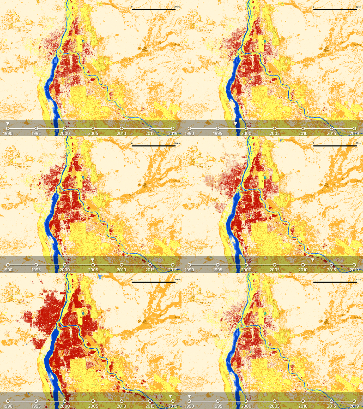
Time serie of high resolution land-cover maps are crucial for assessing changes in the land-cover patterns that either can affect or be induced by climate change. RSLab has the leadership of the High Resolution Land Cover project in the context of the European Space Agency – ESA Climate Change Initiative. Regional products that represent the evolution of land-cover between 1990 and 2019 at 10-30 meters resolution have been produced and are now available for Amazonia, Africa Sahel and Siberia.

These products reaveal detailed and very relevant change patterns that were not visibile in available medium resolution products.

The products are presented in a video produced in collabaration between RSLab and ESA that can be seen here.

More details on the project, the products and their impact in the media news below.


( ! ) Warning: Trying to access array offset on null in /var/www/html/wp-site/wp-content/themes/fizz/category-news.php on line 75
Call Stack
#TimeMemoryFunctionLocation
10.0011458600{main}( ).../index.php:0
20.0013458952require( '/var/www/html/wp-site/wp-blog-header.php ).../index.php:17
30.12525010416require_once( '/var/www/html/wp-site/wp-includes/template-loader.php ).../wp-blog-header.php:19
40.12755036376include( '/var/www/html/wp-site/wp-content/themes/fizz/category-news.php ).../template-loader.php:132

On April 4, Khatereh Meshkini succesfully defended her PhD Thesis on “Advanced Methods for Land Cover Mapping and Change Detection in High Resolution Satellite Image Time Series”.

Congratulations to Khatereh!


( ! ) Warning: Trying to access array offset on null in /var/www/html/wp-site/wp-content/themes/fizz/category-news.php on line 75
Call Stack
#TimeMemoryFunctionLocation
10.0011458600{main}( ).../index.php:0
20.0013458952require( '/var/www/html/wp-site/wp-blog-header.php ).../index.php:17
30.12525010416require_once( '/var/www/html/wp-site/wp-includes/template-loader.php ).../wp-blog-header.php:19
40.12755036376include( '/var/www/html/wp-site/wp-content/themes/fizz/category-news.php ).../template-loader.php:132

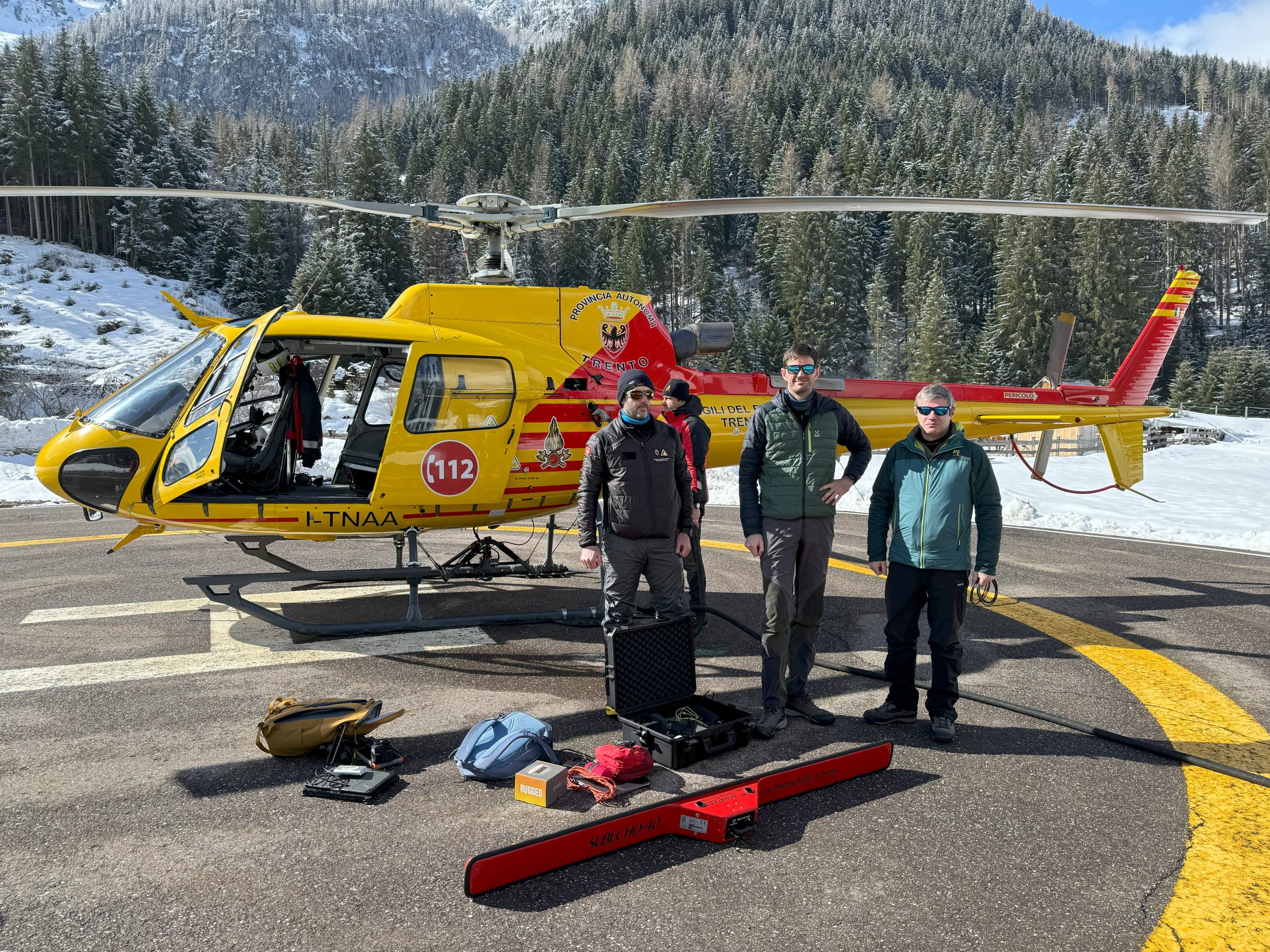
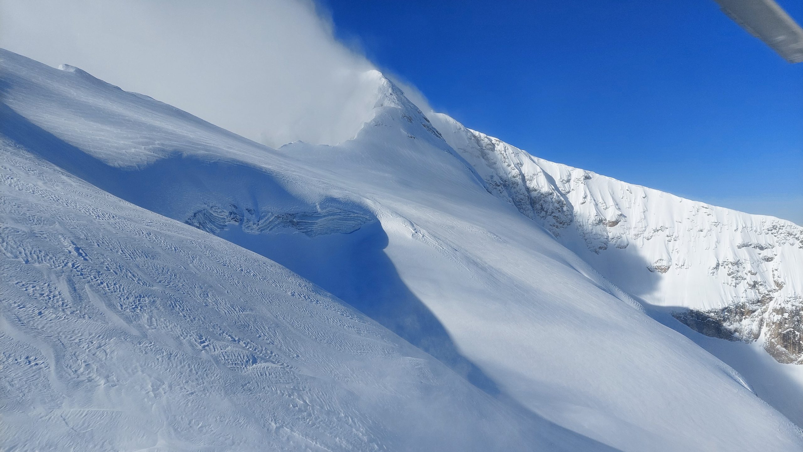
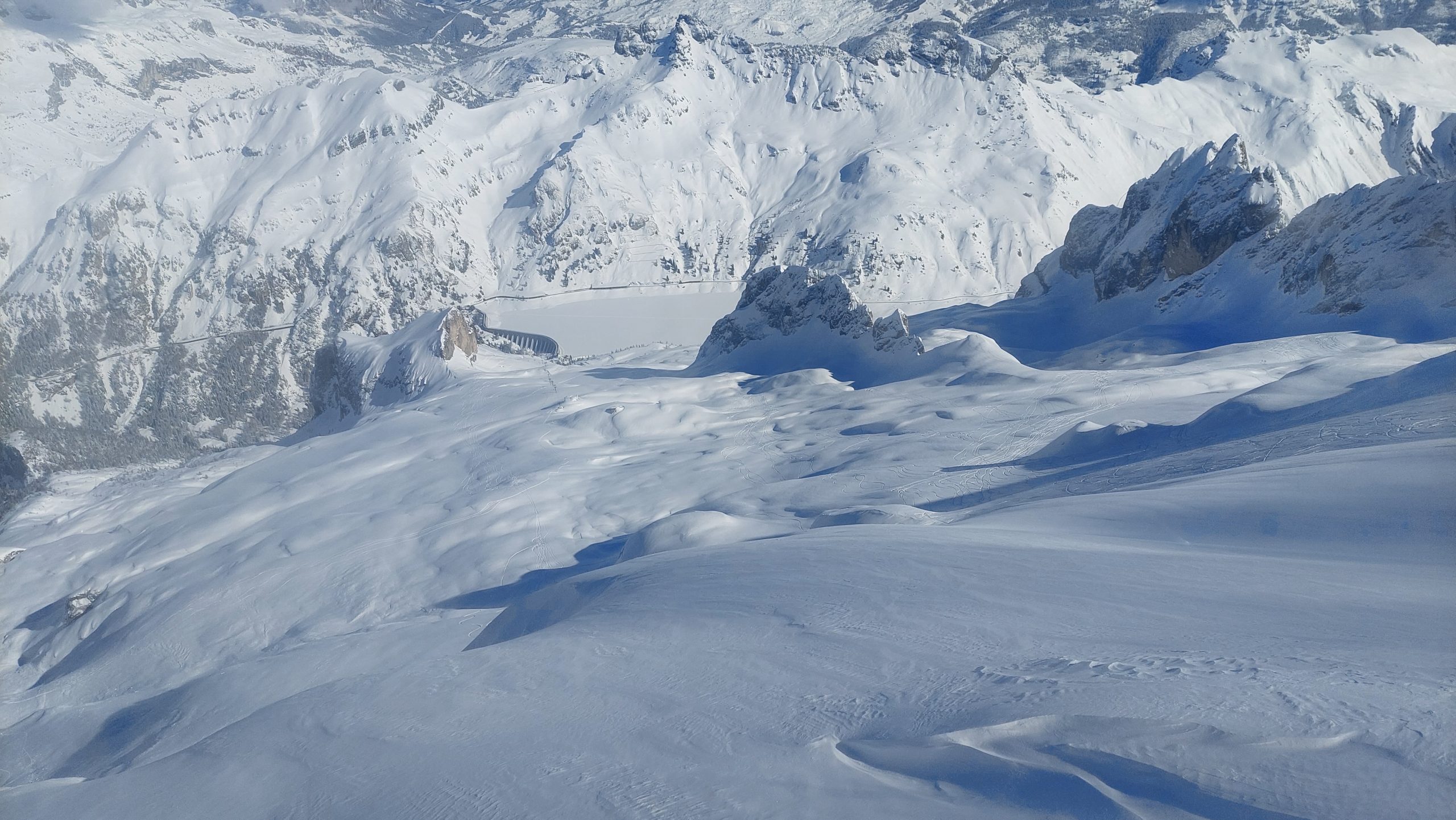
Alpine glaciers are suffering the climate change. RSLab in collaboration with the Risk Prevention and Cue Service and the Geological Service of the Province of Trento and thanks to the support of the Helicopter Unit of the Permanent Fire Brigade of Trento,  is conducting a campaign of measurements on the Marmolada glacier with a Ground Penetrating Radar to characterize the glacier bedrock and study the possibility to identify accumulation of water at the interface between ice and rocks as well as the presence of water in the ice column. After two series of measurements with high temperatures in the Summer 2023, in the past days we acquired data in winter thermal conditions with snow covering the glacier.

Some pictures and videos of the glacier during the campaign as well as some examples of media coverage can be found below.


( ! ) Warning: Trying to access array offset on null in /var/www/html/wp-site/wp-content/themes/fizz/category-news.php on line 75
Call Stack
#TimeMemoryFunctionLocation
10.0011458600{main}( ).../index.php:0
20.0013458952require( '/var/www/html/wp-site/wp-blog-header.php ).../index.php:17
30.12525010416require_once( '/var/www/html/wp-site/wp-includes/template-loader.php ).../wp-blog-header.php:19
40.12755036376include( '/var/www/html/wp-site/wp-content/themes/fizz/category-news.php ).../template-loader.php:132

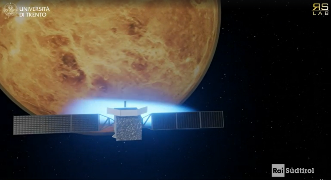
The EnVision mission to Venus and the activities of RSLab in planetary exploration and Earth observation have been recently the focus of some national and regional media insights.

Below some links to TV and radio broadcasts (in italian and german).


( ! ) Warning: Trying to access array offset on null in /var/www/html/wp-site/wp-content/themes/fizz/category-news.php on line 75
Call Stack
#TimeMemoryFunctionLocation
10.0011458600{main}( ).../index.php:0
20.0013458952require( '/var/www/html/wp-site/wp-blog-header.php ).../index.php:17
30.12525010416require_once( '/var/www/html/wp-site/wp-includes/template-loader.php ).../wp-blog-header.php:19
40.12755036376include( '/var/www/html/wp-site/wp-content/themes/fizz/category-news.php ).../template-loader.php:132

The High Resolution Land Cover (HRLC) Essential Climate Variable (ECV) project developed under the Climate Change Initiative (CCI) of ESA started the Phase-2 activities with the Kick-off in ESA ESRIN, Frascati, Italy. RSLab leads the project that involves 11 international partners. In Phase-1 the team produced land-cover maps at 10m resolution of 2019 and time series of land-cover maps at 30m resolution every 5 years between 1990 and 2019 in regions located in Amazon, Africa Sahel and Siberia (see figure below). Yearly based land-cover-change maps have also been generated. These products will be presented in the next weeks (stay tuned).

More about the project:

The main goal of the HR Land Cover ECV project is to study in detail the role of the spatial resolution in the mapping of land cover and land cover changes to support climate modelling research. Accurate land cover mapping and land cover change detection are extremely important for a better understanding of the global climate system. Land cover and related changes are in fact both cause and consequence of climate change either when the change is human-induced or generated from natural events. This has been widely recognized by the scientific community and demonstrated by the previous phase of the CCI programme, focused on the generation of Medium Resolution (MR) land cover maps at global scale. Differently from the MR land cover CCI, which provided annual land cover maps at 300m resolution covering the period 1992-2015, the HRLC project aims at producing maps characterized by a spatial resolution of 10m/30m. Moving from 300m to 30m requires the definition of new data analysis and processing methods, reframing the perspective with respect to the MR project both from the theoretical and the operational view points.

Pages:1234567...19
RSLab
Privacy Overview

This website uses cookies so that we can provide you with the best user experience possible. Cookie information is stored in your browser and performs functions such as recognising you when you return to our website and helping our team to understand which sections of the website you find most interesting and useful.