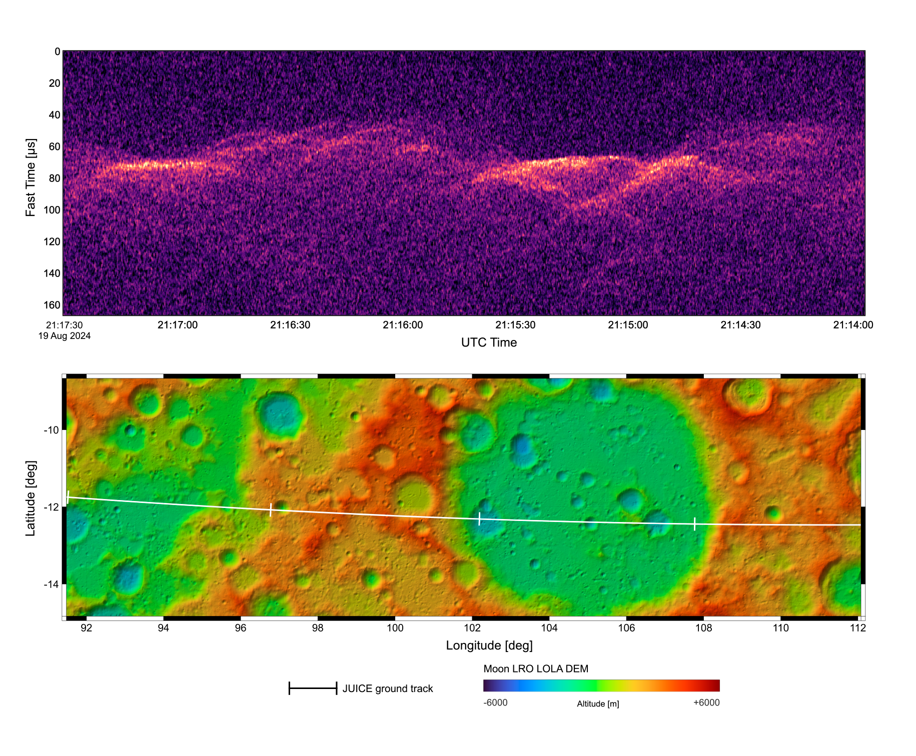
During the first in history gravity assist flyby of the Earth-Moon system, which took place successfully between August 19 and 20, the Radar for Icy Moon Exploration (RIME) was activated and performed a wide range of tests.
During the lunar flyby, RIME was operated to acquire, for the first time since the launch of JUICE, data from the surface of a celestial body. Tests were performed by varying the radar parameters with the aim of better characterizing the functioning of RIME. First analyses of the data show that the instrument is functioning properly and resulted in the generation of the first unfocused RIME radargramme.
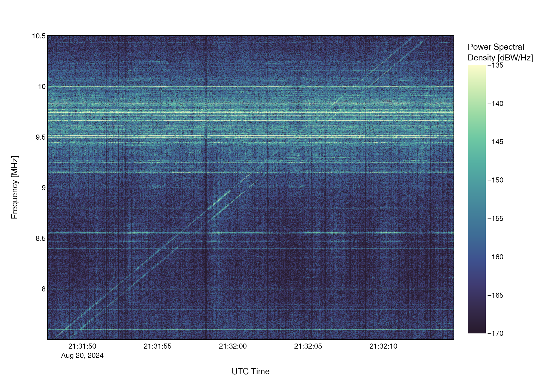
During the Earth flyby, RIME was operated in listen-only mode for both measuring radio signals generated by terrestrial transmissions that are useful for calibration and providing data on the Earth’s ionosphere.
More details here and on some of the media coverage reported below.
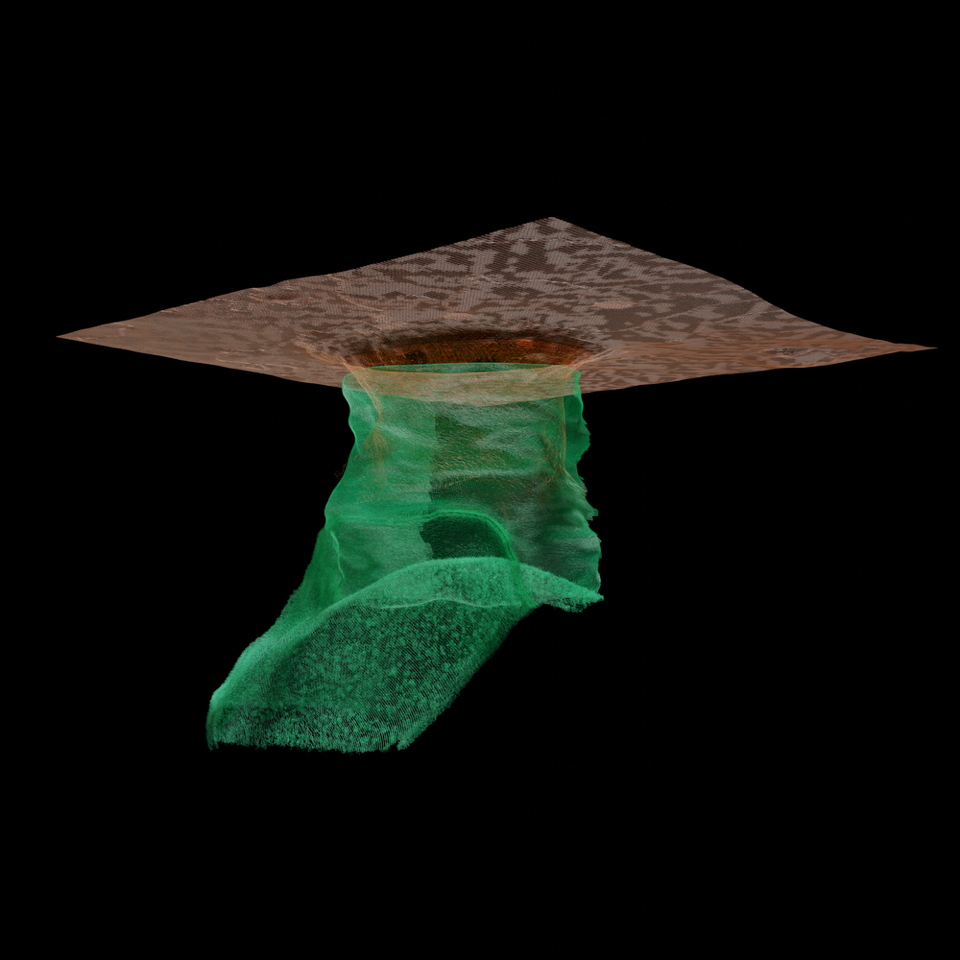
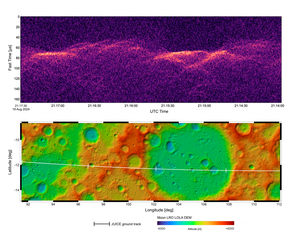 The image presents the first RIME radrgramme the lunar surface and the digital elevation model (DEM) of the area with the spacecraft groundtrack indicated by a white line. The radargram has been generated with preliminary pre-processing (RFI noise mitigation, range compression and simple pre-summing only) and is not focused yet. It shows the surface of the Moon in the area of the flyby, which is a very rough area characterized by large variations of topography as shown in the DEM.
 Spectrogram measured by the RIME in listen-only mode during part of the flyby of the Earth. Many different radio frequency sources are detected and visible in the data.


