
:::: MENU ::::
TOP

Posts Tagged / Earth Observation

  • Nov 02 / 2015
  • News

RSLab involved in a new project on Radar

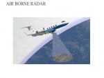
RSLab is involved on a new project approved by Italian Space Agency on the development of an airborne radar with both nadir looking sounding and synthetic aperture imaging capabilities. The radar will work in P band and is developed for applications related to…

  • Nov 10 / 2015
  • News

New project on remote sensing and data fusion for cryosphere

The project CRYOMON-SciPro (Improve the Science of Processes within the Cryosphere by Integrating Hydrological Modelling with Remote Sensing in a Multi-Level Data Fusion Approach – a Contribution to Cryosphere Monitoring in the EUREGIO Region) has been…

Artificial Intelligence for space

Artificial intelligence (AI) is changing and will change more and more in the future the scenario in the space activities and applications. The impact of AI covers almost all the components of space: robotics, autonomous…
  • Aug 28 / 2018
  • News

ExtremeEarth: From Copernicus Big Data to Extreme Earth Analytics

RSLab got a very important new project in the framework of the very challenging ICTcall of Horizon 2020 Research and Innovation Framework Programme of European Commission (average proposal success rate of 8%). The ExtremeEarth  project will concentrate on…
  • Mar 06 / 2025
  • News

Annual review of the ESA CCI + HRLC project!

The HRLC CCI studies and investigates the role of the spatial resolution of land cover and land cover change in supporting climate modelling research at regional scale in key climatic areas in Africa, South America and Siberia. During Phase 1 of the programme, the…

New Maps of Land Cover for Climate Change

Time serie of high resolution land-cover maps are crucial for assessing changes in the land-cover patterns that either can affect or be induced by climate change. RSLab has the leadership of the

Remote sensing for forest monitoring on TV news

The RSLab activities and projects related to remote sensing for forest monitoring have been the focus of a TV report on the national  RAI 3 TG Leonardo and on the RAI TGR . The report  addresses the activities developed by using LiDAR sensors and…
  • Nov 16 / 2021
  • News

Extreme Earth Online Workshop

The ExtremeEarth team and RSLab will present the results of the H2020 ExtremeEarth project regarding innovative AI and bigdata technologies for Earth observation data and how they have been used for food security and the polar regions.…

Climate Change and Remote Sensing: RSLab on the Press

Interview of Prof. Bruzzone on the European Space Agency project that RSLab is coordinating on the use of remote sensing satellites for land cover mapping for climate change monitoring and analysis. The interview is published on the national magazine “La Nuova…
Pages:1234
RSLab
Privacy Overview

This website uses cookies so that we can provide you with the best user experience possible. Cookie information is stored in your browser and performs functions such as recognising you when you return to our website and helping our team to understand which sections of the website you find most interesting and useful.