

Time serie of high resolution land-cover maps are crucial for assessing changes in the land-cover patterns that either can affect or be induced by climate change. RSLab has the leadership of the High Resolution Land Cover project in the context of the European Space Agency – ESA Climate Change Initiative. Regional products that represent the evolution of land-cover between 1990 and 2019 at 10-30 meters resolution have been produced and are now available for Amazonia, Africa Sahel and Siberia.
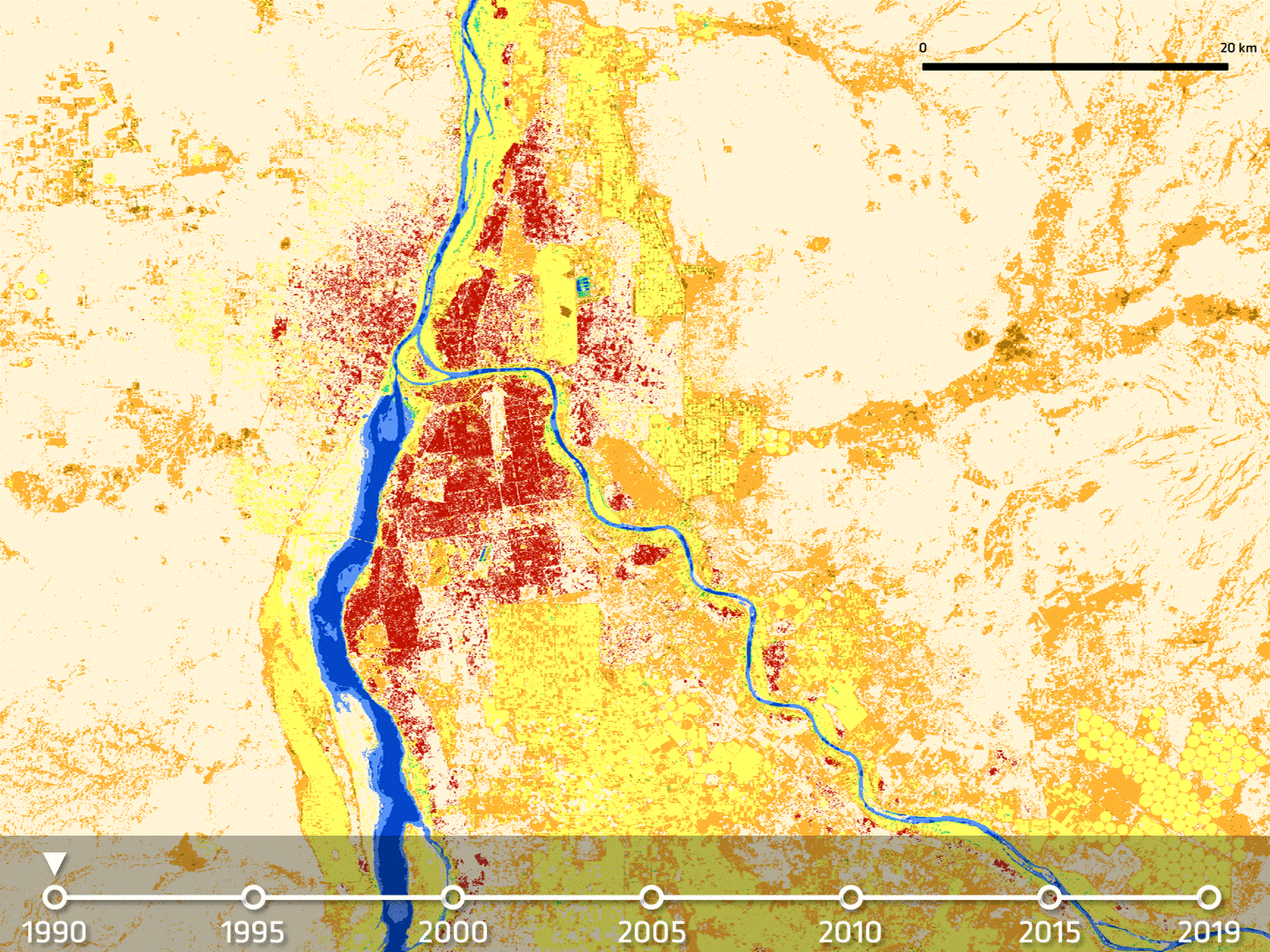
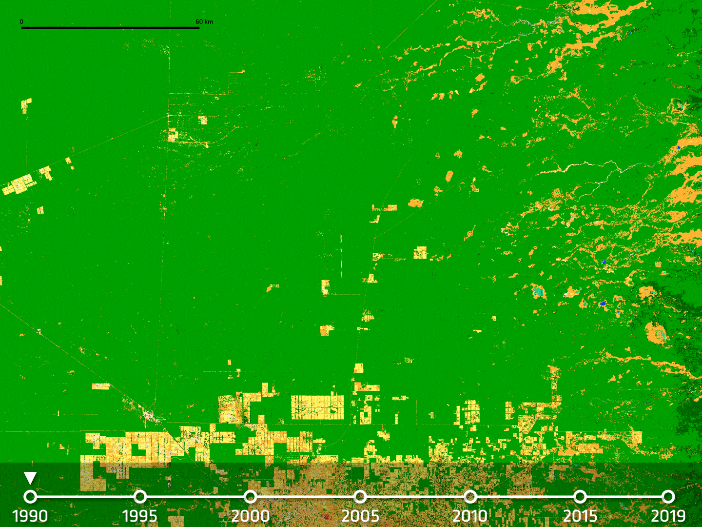
These products reaveal detailed and very relevant change patterns that were not visibile in available medium resolution products.
The products are presented in a video produced in collabaration between RSLab and ESA that can be seen here.
More details on the project, the products and their impact in the media news below.