:::: MENU ::::
TOP

Data Fusion

  • Multi-resolution fusion (pansharpening)
  • Multi-sensor classification techniques
  • Integration of remote sensing, ancillary and in situ data
  • Architectures for multisensor data analysis
  • Change Detection in Multi-Temporal Multi-Sensor data

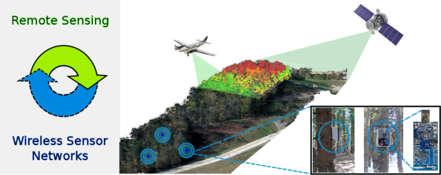
Systems for the integration of Remote Sensing and Wireless Sensor Networks

  • Remote Sensing-based framework for automatic and scalable Wireless Sensor Networks deployment planning in forests


RS_WSN_integration


PhD in cooperation with D3S —Dynamic Distributed Decentralized Systems— group  http://d3s.disi.unitn.it

  • Jan 28 / 2015
  • 0

Lidar

-->

Light Detection and Ranging

  • Analysis of multireturn LiDAR data
  • Automatic classification of LiDAR data
  • Forest segmentation in the 3D LiDAR cloud space
  • Estimation of tree height, diameter and volume
  • Forest mapping using airborne LiDAR data
  • Building edge detection in the 3D LiDAR cloud space
  • Fusion between terrestrial and airborne LiDAR data
  • Fusion between airborne LiDAR data and hyperspectral/multispectral images
  • Multitemporal analysis of airborne LiDAR data
  • Jan 28 / 2015
  • 0

Remote Sensing

-->

Applications

  • Forestry
  • Agriculture
  • Damage Assessment
  • Urban area analysis
  • Building Detection
  • Risk assessment
  • Vegetation monitoring
  • Water quality
  • Snow and ice
  • Climatic changes
Image Processing and Analysis

  • Hyerarchical multilevel segmentation
  • Multiscale/multilevel feature extraction
  • Texture extraction
  • Image denoising
Automatic Classification

  • Statistical methods
  • Machine learning (neural networks, support vector machine, ect)
  • Kernel methods
  • Semisupervised classification
  • Domain adaptation and active learning methods
  • Advanced multiscale feature extraction for VHR image classification
  • Feature selection and classification of hyperspectral images
  • Accuracy assessment in VHR classification maps
  • Classification of SAR signals
Analysis of Multitemporal Images

  • Registration of multitemporal images
  • Modeling and mitigation of registration noise
  • Analysis and classification of multi- and hyper-temporal data
  • Change detection in medium and very high resolution SAR images
  • Change detection in medium and very high resolution Multispectral images
  • Change detection in medium and very high resolution Hyperspectral images
Regression and Estimation

  • Model based regression methods
  • Regression based on machine learning techniques
  • Biophysical parameters estimation

  • Sep 25 / 2014
  • 0

Radar

-->

Synthetic Aperture Radar (SAR)

  • Analysis and modelling of HR and VHR SAR signals
  • Building detection and 3D reconstruction in VHR SAR images
  • Change detection (2D and 3D)
  • Automatic classification
  • Analysis of temporal series of HR and VHR SAR images.

Ground Penetrating Radar and Radar Sounder

  • Statistical analysis and characterization of radar sounder signals
  • Pre-processing techniques (clutter estimation and noise reduction, filtering, etc.)
  • Feature extraction and automatic classification of subsurface layers or patterns
  • Design of radar sounding instruments for planetary exploration

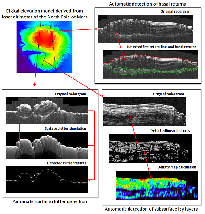
Radar sounder data of the subsurface of the North Pole of Mars acquired by the SHARAD instrument, and examples of possible elaborations:
(top right) automatic detection of basal returns aimed at the estimation of ice thickness and basal topography;
(bottom left) automatic detection of surface clutter returns on radargrams through clutter simulation and matching with real data;
(bottom right) automatic detection and characterization of subsurface linear features aimed at the mapping of icy layers.


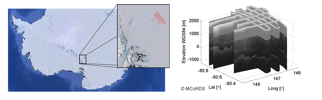
Radar sounder data of the subsurface of Byrd Glacier Antarctica acquired by the MCoRDS instrument, and examples of possible elaborations:
radarsounder_01_intro
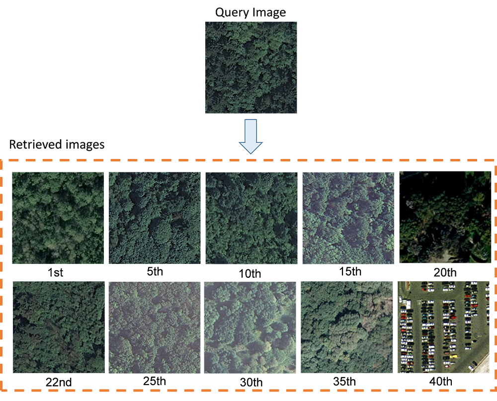
Examples of ice subsurface target classes backscattering and statistical analysis of the measured radar signalradarsounder_02_stat

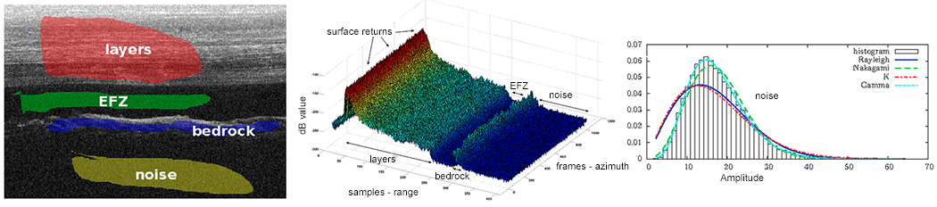
Automatic detection of ice subsurface targets based on segmentation

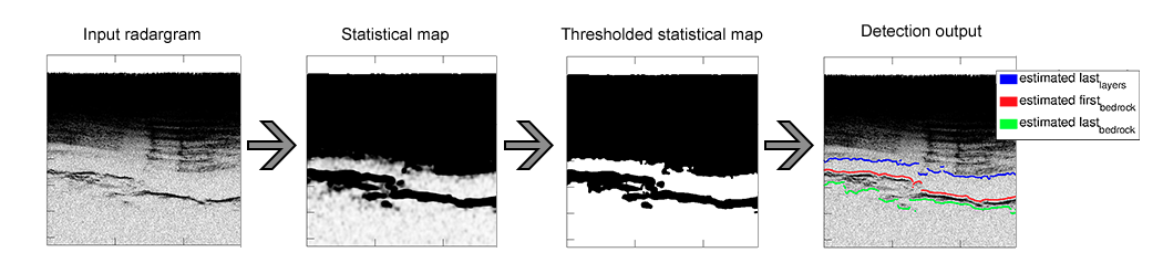
Automatic classification of the ice subsurface based on feature extraction and machine learning

  • Sep 25 / 2014
  • 0

Pattern Recognition

-->

Methods

  • Supervised, semisupervised and unsupervised classification
  • Statistical methods for data analysis
  • Machine learning (neural networks, support vector machine, etc.)
  • Kernel-based methods and support vector machines
  • Domain adaptation and active learning algorithms
  • Multidimensional signal processing
  • 2D and 3D image processing
  • Data fusion

Applications

  • Remote sensing
  • Biomedical Signals and Images
  • Neuroscience
  • Industrial Visual Inspection
  • Others

Biomedical Signals and Images

  • Analysis of retina images for diseases detection and mapping
  • Analisys of MRI and fMRI images
  • Analysis of TAC images
  • Analysis of ECG and ECoG signals
  • Analysis of EEG signals
  • Development of Brain Computer Interface (BCI) systems
Neuroscience

  • Analysis of fMRI signals
  • Analysis of EEG and MEG signals
  • Fusion between EEG, MEG and fMRI data
  • Pattern recognition for cognitive analysis

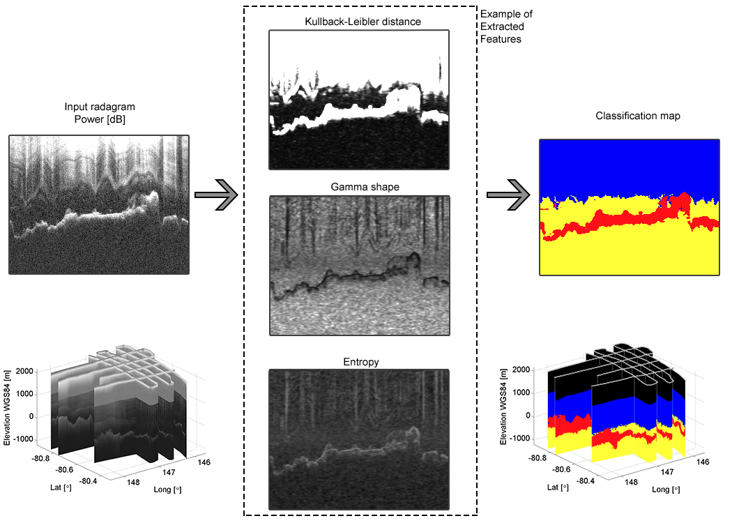
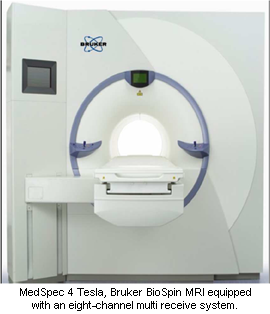
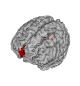
Laboratory of Functional Neuroimaging, CIMeC.


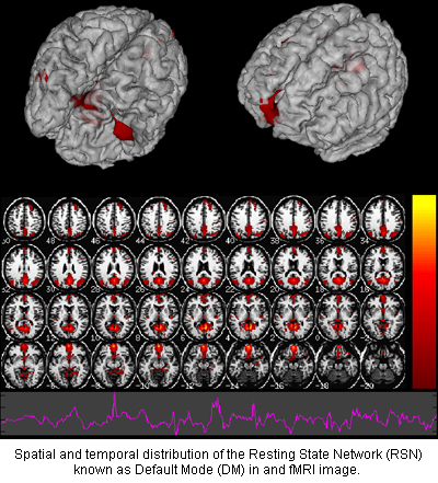
This activity is developed in cooperation with CIMeC – Centro interdipartimentale Mente/Cervello (Center for Mind/Brain Sciences), University of Trento.

Industrial Visual Inspection

  • Fig Quality Assessment

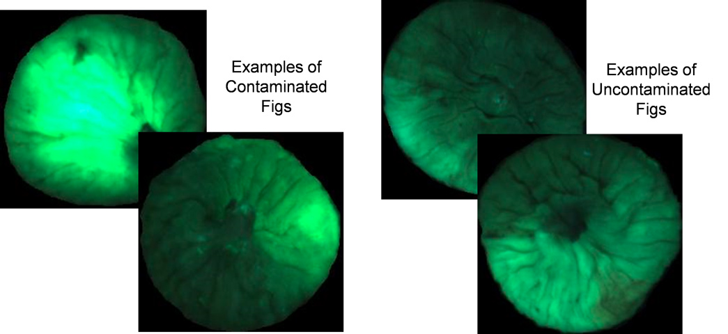
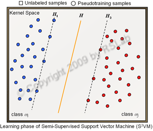
This activity is developed in cooperation with the Vision-Image Processing and Pattern Recognition Laboratory, Süleyman Demirel University, Isparta, Turkey.

Content-Based Image Retrieval (CBIR)

  • Image Feature Extraction for CBIR problems
  • Fast content-based Image Retrieval
  • Relevance Feedback Driven by Active Learning