
- Analysis of multireturn LiDAR data
- Automatic classification of LiDAR data
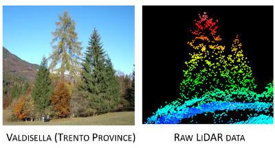
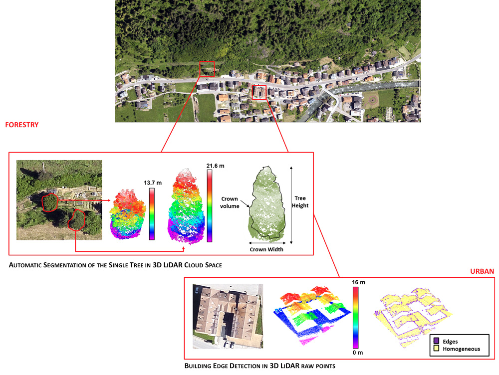
- Forest segmentation in the 3D LiDAR cloud space
- Estimation of tree height, diameter and volume
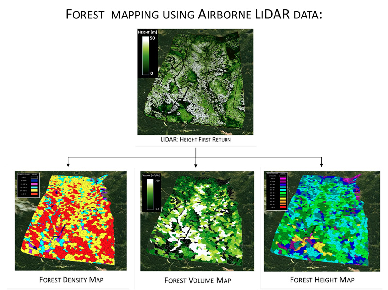
- Forest mapping using airborne LiDAR data
- Building edge detection in the 3D LiDAR cloud space
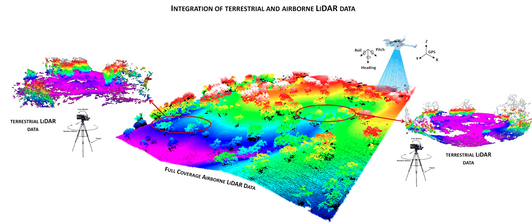
- Fusion between terrestrial and airborne LiDAR data
- Fusion between airborne LiDAR data and hyperspectral/multispectral images
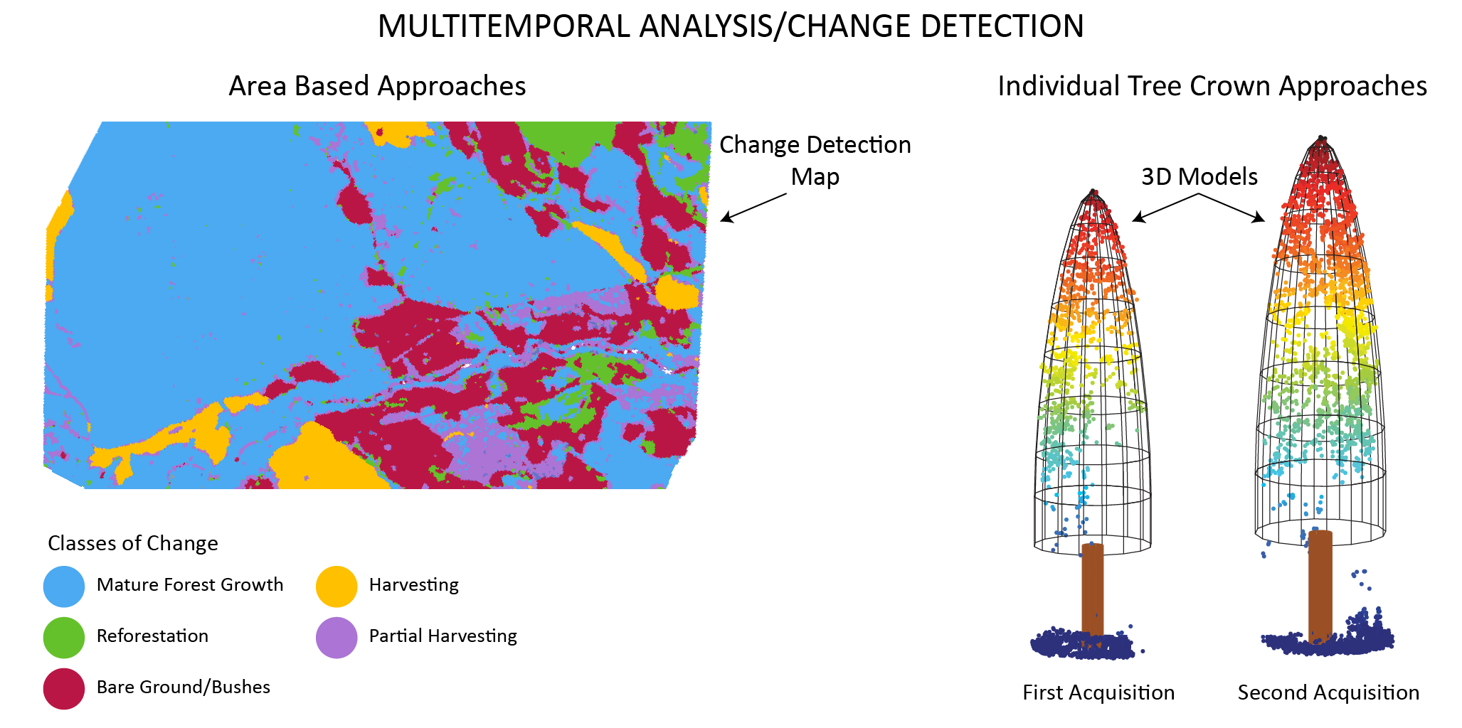
- Multitemporal analysis of airborne LiDAR data