 Massimo Zanetti
 I received the MS’s degree in Mathematics (summa cum laude) from the University of Ferrara, Department of Mathematics and Computer Science (Ferrara, Italy), and the PhD (cum laude) in Communication and Information Technologies from the University of Trento, Department of Information Engineering and Computer Science (Trento, Italy). Currently, I am a researcher at the Remote Sensing for Digital Earth Unit, Fondazione Bruno Kessler, (Trento, Italy). My research interests are mainly focused on image analysis in a wide sense. Some specific topics covered are multispectral/hyperspectral images change detection, time series analysis, variational methods for segmentation and numerical optimization methods for image processing problems.
Since my MS’s degree in Mathematics at the University of Ferrara, I begun studying remote sensing image problems both from the theoretical and applicative viewpoints. My MS’s thesis was focused on developing novel mathematical models for the segmentation of very high resolution aerial images and LiDAR data and it was written in collaboration with the Department of Civil, Environmental and Mechanical Engineering at the University of Trento. I continued my studies on remote sensing topics related to image analysis as a PhD student in the Information Engineering and Computer Science Department at the University of Trento. During my PhD, I have further expanded the range of my research interests towards multi- and hyper-spectral image analysis with emphasis on change detection applications. My PhD thesis includes contributions mainly related to numerical methods for remote sensing image analysis. More specifically: theoretical properties of tiling schemes applied to variational methods for large size images segmentation, and, statistical approaches to image modelling and related inference in the framework of change detection. The thesis has been awarded as best thesis of the year by two of the main Italian communities related to information engineering and remote sensing: Gruppo Telecomunicazioni e Tecnologie dell’Informazione (GTTI) and IEEE Geoscience and Remote Sensing Center-North Italy Chapter (IEEE GRS29-CNI).
My research is published on high-rated peer-reviewed international journals and presented at the main topic-related international conferences. I am reviewer for international journals in the fields of image analysis and processing, methods to numerical optimization for image problems and remote sensing applications. My activity involves contributions to remote sensing applications also in the context of several projects at both national and European levels (European Space Agency, Italian Ministry of Education, and others). These include development of advanced techniques for analysis of remote sensing images, exploitation of satellite-borne operational missions for time-series analysis, change detection and land cover mapping, study of the impact of land cover in climate changes through remote sensing data.


mazanetti (at) fbk.eu
 Elena Donini
 received the “Laurea” (B.Sc.) degree in Electronics and Telecommunications Engineering, the “Laurea Magistrale” (M.Sc.) degree in Telecommunications Engineering (cum laude), and the Ph.D. in Information and Communication Technologies (cum laude) from the University of Trento, Italy, in 2015, 207, 2021, respectively. She is the recipient of the prizes for the 2022 Best Italian Ph.D. Thesis and 2018 Best Italian master Thesis in remote sensing awarded by the Italian Chapter of the IEEE Geoscience and Remote Sensing Society. She is currently a postdoctoral researcher at the Remote Sensing Laboratory of the University of Trento and the Remote Sensing for Digital Earth Unit of the Fondazione Bruno Kessler, Trento, Italy. Her research interests are related to the automatic analysis of radar sounder data for Earth observation and planetary exploration. She is a referee for several journals, including the IEEE TRANSACTIONS ON GEOSCIENCE AND REMOTE SENSING and the Astronomy & Astrophysics journals.

edonini (at) fbk.eu
 Luca Bergamasco
 Luca Bergamasco received the “Laurea” (B.Sc.) degree in Electronics and Telecommunication Engineering, the “Laurea Magistrale” (M.Sc.) degree in Information and Communication Engineering, and the Ph.D. in Information and Communication Technologies (cum laude) from the University of Trento, Italy, in 2016, 2018, and 2022, respectively. He is the recipient of the prizes for the 2019 Best Three Italian Master thesis and the 2023 Best Three Italian PhD thesis in Geoscience and Remote Sensing awarded by the Italian Chapter of the IEEE Geoscience and Remote Sensing Society. He is currently a postdoctoral researcher at the Remote Sensing for Digital Earth Unit (RSDE) at the Fondazione Bruno Kessler (FBK), Trento, Italy. He is a referee for several journals, including the IEEE Transactions on Geoscience and Remote Sensing and the IEEE Journal of Selected Topics in Applied Earth Observations and Remote Sensing. His research interests are related to remote sensing data analysis through machine learning, pattern recognition, and deep learning techniques. Some research topics involve Deep Learning methods for multitemporal image analysis, change detection in multispectral, hyperspectral, SAR, multi-modal data, time series analysis, and domain adaptation.
lbergamasco (at) fbk.eu
 Miguel Hoyo García
 received his Bachelor’s degree in Telecommunications Technologies Engineering and the Master’s Degree in Telecommunications Engineering from the University of Granada, Spain, in 2014 and 2016, respectively. He is currently pursuing the Ph.D. degree as member of the Remote Sensing Laboratory at the Department of Information and Communication Technologies, University of Trento and the Remote Sensing for Digital Earth Unit, Fondazione Bruno Kessler, Trento, Italy. His research interests are related to the processing of radar sounder data of the subsurface through machine learning, pattern recognition and deep learning techniques.
mhoyogarcia (at) fbk.eu
 Priyanka Kumari
 received the B.Tech. degree in Electrical and Electronics Engineering from BPUT, Rourkela, India, in 2013, and the M.Tech. degree in Remote Sensing from BIT Mesra, Ranchi, India, in 2015. She obtained the Ph.D. degree in Remote Sensing from the National Institute of Technology Karnataka, Surathkal, India, in 2024. She previously worked as an Institute Post-Doctoral Fellow with the Department of Civil Engineering, Indian Institute of Technology Guwahati, India, and is currently a Post-Doctoral Researcher at the Remote Sensing Laboratory, University of Trento, Italy. Her research interests include hyperspectral image analysis, machine learning, planetary surface studies, and radar sounder data analysis.
priyanka.kumari (at) unitn.it
 Indira Aprilia Listiani
 received her B.Sc. in Geological Engineering from Middle East Technical University in Ankara, Turkey in 2018; and her M.Sc. in Geodetic and Geographic Information Technologies from Middle East Technical University in Ankara, Turkey in 2021. She is currently pursuing her Ph.D. as a joint member of the Remote Sensing Laboratory at the Department of Information and Communication Technologies at the University of Trento and the Remote Sensing for Digital Earth Unit, Fondazione Bruno Kessler, in Trento, Italy. Her research interests are related to the applications of geographic information systems, remote sensing, and machine learning for environmental and climate change adaptation studies.
ilistiani (at) fbk.eu
 Marco Cortellazzi
 received the “Laurea” (B.Sc.) degree in Electronics and Telecommunication Engineering and the “Laurea Magistrale” (M.Sc.) degree in Information and Communication Engineering from the University of Trento, Italy, in 2017 and 2021, respectively. He is currently a Ph.D. student in Information Engineering and Computer Science at the Remote Sensing Laboratory (RSLab) of the University of Trento, Italy. His research interests are related to the use of radar sounders and data simulations for space exploration missions.
marco.cortellazzi (at) unitn.it
 Ludovica Maria Beati
 Beati received the “Laurea” (B.Sc.) degree in Engineering of Computing Systems from the Politecnico di Milano in 2019, and the “Laurea Magistrale” (M.Sc.) degree in Information and Communication Engineering from the University of Trento in 2021. She is currently a Ph.D. student at the Department of Information Engineering and Computer Science, University of Trento, Italy. Her research interests are related to planetary radar sounders for studying the subsurface of the planets of the Solar
system.
ludovicamaria.beati (at) unitn.it
 Jordy Dal Corso
 received his Bachelor’s degree in Applied Mathematics and his Master’s degree in Data Science, both with full marks and honors, from the University of Verona, Italy, in 2020 and 2022, respectively. He is currently pursuing a Ph.D. in Information Engineering and Computer Science at the University of Trento, Italy, as a member of the Remote Sensing Laboratory. His doctoral research is supported by the European Space Agency (ESA) under the EnVision mission to Venus.
He has been a guest researcher at the Machine and Human Intelligence Laboratory, University of Helsinki, and at the Max Planck Institute for Intelligent Systems in Tübingen, Germany, where he worked on simulation-based inference for the discovery and uncertainty quantification of terrain parameters from planetary radar acquisitions. His research interests include deep learning, recurrent models, and Bayesian and simulation-based inference for efficient and automated analysis of planetary radar data, with a broader focus on the intersection between machine learning and physical modeling.

jordy.dalcorso (at) unitn.it
 Mattia Ferrari
 received the bachelor’s degree and the master’s degree (summa cum laude) in Information and Communication Engineering from the University of Trento, Italy, in 2020 and 2022, respectively. He is currently a PhD student in Information and Communication Technology at the Remote Sensing Laboratory of the University of Trento. His research interests involve deep learning techniques for the analysis of satellite remote sensing images.
mattia.ferrari-2 (at) unitn.it
 Yongjie Zheng
 received the M.S. degree in photogrammetry and remote sensing from Tongji University, Shanghai, China. She is currently a Ph.D. student in the Department of Information Engineering and Computer Science, University of Trento, Italy. Her research interests include artificial intelligence, multimodal change detection and high-resolution image processing.
yongjie.zheng (at) unitn.it
 Milkisa Yebasse
 received master’s degree in computer engineering at Kumoh National Institute of Technology. Currently, he is a Ph.D. student at the Department of Information Engineering and Computer Science at University of Trento, Italy. His research interests include computer vision, deep learning, and application of machine learning and artificial intelligence for planetary radars.
milkisa.yebasse (at) unitn.it
 Lisa Molaro
 received her Bachelor’s degree in Geology from the University of Trieste, Italy, and her Master’s degree in Geological Sciences and Technologies of Earth and Planets from the University of Chieti – Pescara, Italy, in 2020 and 2022 respectively. She is currently pursuing a Ph.D. degree as a member of the Remote Sensing Laboratory at the department of Information Engineering and Computer Science, University of Trento, Italy. Her research interests are related to the study of planetary surfaces and interiors from remote sensing data.
lisa.molaro (at) unitn.it
 Prashant Pandit
 After studying Mathematics in India, I Joined the ITC Faculty of Geo-information science and earth observations, University of Twente, the Netherlands, where I completed my Master’s Spatial Engineering in August 2022. In my PhD at the department of Information Engineering and Computer Science, the University of Trento, I am working closely with MASSIVE (MAchine learning, Surface mass balance of glaciers, Snow cover, In-situ data, Volume change and Earth observation) Project at Eurac (Bolzano, Italy). My research interest includes the use of multi-sensor satellite data and ML (Machine learning) and DL (Deep Learning) for Glacier studies.
prashant.pandit (at) unitn.it
 Milena Atanasova
 finished her Bachelor’s degree in Business and Economics (cum laude) at University of Bologna (with one year at McGill University in Canada) in 2020, and received her Master’s degree in Data Science (cum laude) from the University of Trento in 2023. She is beginning the pursuit of a PhD in Artificial intelligence for remote sensing time series analysis. Her interests include deep learning analysis of multitemporal multispectral and hyperspectral optical remote sensing data.
milena.atanasova (at) unitn.it
 Aadhithya Sankara Narayanan
 received Integrated Master's degree (M.Tech) in Geoinformatics from Central University of Jharkhand, Ranchi. Currently she is pursuing Phd degree as a member of Remote Sensing Laboratory at the Department of Information and Communication Technology (ICT), University of Trento, Italy. Her research topics is Automatic analysis of hyper-spectral and multi-spectral satellite remote sensing images using Artificial Intelligence and Machine Learning techniques. Her research interests are related to application of artificial intelligence, Digital image processing to remote sensing data, multi-sensor satellite data fusion.
a.sankaranarayanan (at) unitn.it
 Aanchal Sharma
 received her Bachelor of Technology (B.Tech) degree in Electronics and Communication from JNGEC Sundernagar and Master of Technology (M.Tech) degree in Remote Sensing & GIS with a specialisation in Satellite Image Analysis and Photogrammetry from the Indian Institute of Remote Sensing, Indian Space Research Organisation, Dehradun, India. Currently, she is pursuing a Ph.D. as a member of the Remote Sensing Laboratory within the Department of Information and Communication Technologies at the University of Trento, Italy. Her research interests are in radar signal processing, machine learning algorithms, and planetary geology.
aanchal.sharma (at) unitn.it
 Giulio Vaccari
 received the "Laurea" (B.Sc.) degree in Computer Science from the Alma Mater Studiorum - University of Bologna in 2018 and the "Laurea Magistrale" (M.Sc.) degree in Artificial Intelligence from the Alma Mater Studiorum - University of Bologna in 2023. He is currently a Ph.D. student at the Remote Sensing Laboratory, Department of Information Engineering and Computer Science, University of Trento, Italy. His research interests are related to the development of new machine learning-based methodologies for the analysis of remote sensing data acquired in planetary and/or Earth observation space missions.
giulio.vaccari (at) unitn.it
 Houcai Guo
 received the Master of Science (M.Sc.) degree in Remote Sensing of Geographical Environment from the School of Geography, Nanjing Normal University,
China. He is currently a Ph.D. student at the Remote Sensing Laboratory, Department of Information Engineering and Computer Science, University of Trento, Italy. His research interests include the registration, spatiotemporal fusion, and time-series analysis of remote sensing images.
houcai.guo (at) unitn.it
 Hao Liu
 received the Bachelor's and Master's degree in Electronic Information Engineering from Xidian University, China, in 2021 and 2024, respectively. He is currently a Ph.D. student in the Department of Information Engineering and Computer Science at University of Trento in Italy. His research interests lie in applying deep learning algorithms to facilitate the fusion and interpretation of multi-source remote sensing data.
hao.liu (at) unitn.it
 Jana Wicklein
 received a joint Bachelors degree in New Media from the City University of Hong Kong, and the Leuphana University in Lüneburg, Germany. She received her Master’s degree in Data Science (cum laude) from the University of Trento, Italy. She is beginning the pursuit of a PhD as a joint member of the Forest Ecology unit at the Edmund Mach Foundation and the Remote Sensing Laboratory at the University of Trento. Her research interests are related to the development of automatic techniques for forest monitoring using remote sensing satellite time series.
janaannika.wicklein (at) unitn.it
 Muhammad Fasih Ishfaq
 received his master’s degree in Space Science from the Department of Space Science, University of the Punjab Lahore Pakistan in 2018. He is currently pursuing a Ph.D. degree as a member of Remote Sensing Laboratory at the Department of Information and Communication Technologies, University of Trento. His research interests involve artificial intelligence and machine learning for the analysis of multisensory and multitemporal Earth observation data.
muhammadfasih.ishfaq (at) unitn.it
 Dev Dinesh
 his Bachelor of Technology (B.Tech) degree in Information Technology from AKTU, Lucknow, India, in 2020. He then completed a Post-Graduate Diploma in Remote Sensing and GIS, specializing in Satellite Image Analysis and Photogrammetry, in 2021. In 2023, he earned a Master of Technology (M.Tech) degree in Remote Sensing & GIS with a specialization in Geoinformatics from the Indian Institute of Remote Sensing (IIRS), Indian Space Research Organization (ISRO), Dehradun, India. He has received several awards and honors, including the Golden Jubilee Fellowship from IIRS-ISRO for three consecutive years, and has won two best paper awards. Previously, he worked with prestigious organizations such as ISRO and The World Bank. His research interests include SAR polarimetry, SAR-based modeling, spatial data science, framework and software development. Currently, he is pursuing a Ph.D. in the Department of Information Engineering and Computer Science at the University of Trento, Italy. His active research areas are artificial intelligence and signal processing for planetary radar.
dev.dinesh (at) unitn.it
 Priti Girohi
 received her Bachelor of Technology (B.Tech) degree in Electronics and Communication Engineering from AKTU, Lucknow, India. Driven by a strong interest in radar and space technologies, she pursued a Master of Technology (M.Tech) in Satellite Image Analysis and Photogrammetry at the Indian Institute of Remote Sensing (IIRS), Indian Space Research Organisation (ISRO), Dehradun, India. Her master's thesis focused on enhancing InSAR-derived DEMs using data fusion, where she developed a novel enhancement algorithm and implemented ANN frameworks for fusion-based DEM improvements. Her research interests include SAR, InSAR, radar data processing, algorithm development, and the application of AI/ML in remote sensing. She is currently pursuing a Ph.D. at the Remote Sensing Laboratory, Department of Information and Communication Engineering, University of Trento, Italy.
priti.girohi (at) unitn.it
 Federico Ghio
 earned his M.Sc. in Space Engineering from Politecnico di Milano in 2025, following a B.Sc. in Aerospace Engineering from Politecnico di Torino. Throughout his studies, he focused on Earth Observation, space systems and project management, joining international programmes to enhance his transferable skills. As part of his master’s research, he spent over a year at the German Aerospace Center (DLR) working on Bayesian deep learning for forest monitoring from InSAR data, a line of research he is now pursuing as a PhD candidate jointly affiliated with DLR and the Remote Sensing Laboratory at the University of Trento.
federico.ghio (at) dlr.de
 Marco Lecci
 Marco Lecci received the bachelor and the master degrees in Electronic and Telecommunications Engineering from University of Florence in 2017 and 2022. His academic and professional interests focus on electromagnetism and radar systems. After gaining experience in algorithm development for X-band Pulsed Doppler AESA radar in Milan, Marco shifted his attention to radar sounders applied to space exploration and glaciological monitoring. This transition aligns with his personal interests in mountains and glaciers.
Currently, as a doctoral student in Space Science and Technology at the Remote Sensing Laboratory, Department of Information Engineering and Computer Science, University of Trento, he investigates advanced simulation methods for radar returns from complex glaciological targets, develops algorithms for image focusing and clutter removal, and explores automatic techniques for layer detection and natural target recognition. His research aims to enhance the performance of the STRATUS mission by providing robust and reliable information to the scientific community.
marco.lecci (at) unitn.it
 Lorenzo Bruno Garavelli
 obtained his Bachelor of Science degree in Aerospace Engineering and Master of Science degree in Space Engineering from Politecnico di Milano in 2022 and 2025, respectively. He conducted his master's thesis work at the Microwaves and Radar Institute of the German Aerospace Center (DLR), where he developed a Convolutional Neural Network for the denoising and compression of InSAR phase. He is currently pursuing a Ph.D. with the DLR Microwaves and Radar Institute and the Remote Sensing Laboratory at the University of Trento. His research interests involve the use of Deep Learning methods to combine data from multiple satellites for regression tasks in Earth Observation.
lorenzobruno.garavelli (at) dlr.de
 Amit Swain
 received his bachelor's and interdisciplinary master’s degree in mining engineering from National Institute of Technology, Rourkela, India, in 2019. His masters work focused on RF propagation modelling for wireless sensor networks in underground mines. He then joined the Sensing Lab of TCS Research, Kolkata as a Scientist, where he worked on UGV-borne ground-penetrating radar, subsurface imaging algorithms, and multi-sensor systems for mining and industrial applications. He has received several awards, including NIT Rourkela Branch Topper Medal and the MathWorks Best Paper Award at IEEE Microwaves, Antennas and Propagation Conference 2025. Currently, he is pursuing a Ph.D. (National PhD Programme in Space Science & Technology) as a member of the Remote Sensing Laboratory, Department of Information Engineering and Computer Science, University of Trento, Italy. His interests include radar signal processing, subsurface imaging, machine learning and planetary geology. His research aims at signal processing and AI-based analysis of planetary radar sounder data, specifically for the RIME instrument onboard ESA’s JUICE mission.
amit.swain (at) unitn.it
 Krishangi Kashyap
 received the Bachelor of Science (B.Sc.) degree in Physics from Gauhati University in 2021 and the Master of Science (M.Sc.) degree in Astronomy from the Indian Institute of Technology Indore, India, in 2024. She is currently pursuing a PhD as a member of the Remote Sensing Laboratory within the Department of Information Engineering and Computer Science at the University of Trento, Italy. Her master's thesis focused on Chandrayaan-2 Dual-Frequency SAR data for subsurface dielectric inversion, in which she developed a neural network-based multi-layer perceptron to study volatile abundance. Her research interests include radar sounder data analysis to study planetary surfaces and subsurfaces of the solar system, as well as the application of AI/ML and Deep Learning in planetary radars.
krishangi.kashyap (at) unitn.it
 Anurupa Goswami
 did her Bachelor of Technology (BTech) degree in electronics and Communication from AKTU, India in 2022. She then earned a Master of Technology (MTech) degree in Remote Sensing & GIS with a specialization in Satellite Image Analysis and Photogrammetry in 2024. She also worked with organization such as Indian Institute of Technology (Indore), India as a researcher with experience of satellite and drone data analysis of lidar, optical data. Till date throughout her academic career, she has published research, review, conference papers and 2 patents. Currently, she is pursuing a Ph.D. in the Department of Information Engineering and Computer Science at the University of Trento, Italy with collaboration with FBK. Her active research areas are land cover change analysis, semantic segmentation, machine learning and deep learning algorithms.
agoswami (at) fbk.eu
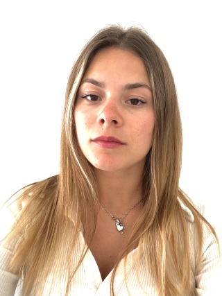
 Margarret Ashmitha Antony Ravi
 received her B.E. degree in Geoinformatics from College of Engineering, Guindy, Anna University, India in 2020. She completed her M.Sc. in Geoinformation Science and Earth Observation from University of Twente (Faculty ITC), the Netherlands in 2022, as part of the joint education program with the Indian Institute of Remote Sensing, Indian Space Research Organisation, Dehradun, India. She worked as a Research Fellow at Indian Institute of Technology Hyderabad, India. Currently, she is pursuing her Ph.D. as a joint member of the Remote Sensing Laboratory at the Department of Information Engineering and Computer Science, University of Trento, and the Remote Sensing for Digital Earth Unit at Fondazione Bruno Kessler, in Trento, Italy. Her research interests include geospatial artificial intelligence, explainability, self-supervised learning, and multi-spectral and multi-temporal remote sensing.
mantonyravi (at) fbk.eu
 Wenxiu Diao
 received the B.S. and M.S. degrees in computer science and technology from Shandong Normal University, Jinan, China, in 2019 and 2022, respectively. She is currently pursuing the Ph.D. degree in computer science and technology with the School of Computer Science and Engineering, Nanjing University of Science and Technology, Nanjing, China, while concurrently serving as a visiting Ph.D. student at the Department of Information Engineering and Computer Science, University of Trento, Italy. Her research focuses on image processing and deep learning.
wenxiu.diao (at) studenti.unitn.it
 Liaoran Gao
 Gao received the B.S. degree from the College of Resource and Environment, Lanzhou University, China, in 2019 and M.S degree from the University of Chinese Academy of Science, China, in 2022. He is currently pursuing a Ph.D. degree in Institution of Geographic Science and Nature Resource at Chinses Academy of Science, China. He is also a visiting Ph.D. student at the Department of Information Engineering and Computer Science, University of Trento, Italy. His research interests include crop classification based on remote sensing, Open-set classification and its application.
liaoran.gao (at) studenti.unitn.it
 Yuting Liu
 received her bachelor's degree from China University of Mining and Technology in 2019. She is currently a Ph.D. candidate in a combined master’s and doctoral program at the School of Resources and Environment, University of Electronic Science and Technology of China, and a visiting Ph.D. student at the Department of Information Engineering and Computer Science, University of Trento, Italy. Her research focuses on bi-temporal change detection in high-resolution optical and synthetic aperture radar imagery.
yuting.liu (at) guest.unitn.it
 Håkon Næss Sandum
 Sandum received his B.Sc. and M.Sc. degrees in Forest Sciences from the Norwegian University of Life Sciences (NMBU). He is currently pursuing a Ph.D. at the Faculty of Environmental Sciences and Natural Resource Management, NMBU, focusing on the application of deep learning and remote sensing for forest mapping. His research aims to automate stand delineation using multispectral aerial imagery and airborne laser scanning data. He is also serving as a visiting Ph.D. student at the Department of Information Engineering and Computer Science, University of Trento, Italy.
hakonnaess.sandum (at) unitn.it
 Julius Wold
 received a master's degree in forestry from the Norwegian University of Life Sciences in 2022. He is currently pursuing a PhD degree at the Norwegian University of Life Sciences, focusing on deep learning applications for forest mapping. His research focus is on the use of historical aerial imagery for the mapping of natural forests.
julius.wold (at) unitn.it
 Hengyi Zheng
 is currently pursuing the Ph.D. degree in artificial intelligence with the College of Artificial Intelligence and Automation, Hohai University, Nanjing, China. She is also a visiting student in the Remote Sensing for Digital Earth (RSDE) research unit at Center for Digital Society, Fondazione Bruno Kessler. Her research interests include collaborative representation, graph neural network, machine learning, deep learning and hyperspectral remote sensing imagery classification.
hzheng (at) fbk.eu
 Shuyi Xu
 received her bachelor's degree from China University of Geosciences (Wuhan) in 2022. She is currently a direct-entry Ph.D. candidate at the Aerospace Information Research Institute, Chinese Academy of Sciences, China, while concurrently serving as a visiting Ph.D. student at the Remote Sensing for Digital Earth Unit, Fondazione Bruno Kessler, Trento, Italy. Her research focuses on bi-temporal change detection in hyperspectral imagery.
sxu (at) fbk.eu


 Lorenzo Bruzzone Lorenzo Bruzzone received the Laurea (M.S.) degree in electronic engineering (summa cumlaude) and the Ph.D. degree in telecommunications from the University of Genoa, Italy, in 1993 and 1998, respectively. He is currently a Full Professor of telecommunications at the University of Trento, Italy, where he teaches remote sensing, radar, and digital communications.
Dr. Bruzzone is the founder and the director of the Remote Sensing Laboratory in the Department of Information Engineering and Computer Science, University of Trento. His current research interests are in the areas of remote sensing, radar and SAR, signal processing, machine learning and pattern recognition. He promotes and supervises research on these topics within the frameworks of many national and international projects. He is the Principal Investigator of many research projects. Among the others, he is currently the Principal Investigator of the Radar for Icy Moon Exploration (RIME) and of the Subsurface Radar Sounder (SRS) instruments in the framework of the JUpiter ICy moons Explorer (JUICE) and the Envision missions, respectively, of the European Space Agency (ESA) and is the for the High Resolution Land Cover project in the framework of the Climate Change Initiative of ESA. He is the author (or coauthor) of more than 410 scientific publications in referred international journals, more than 390 papers in conference proceedings, and 25 book chapters. He is editor/co-editor of 18 books/conference proceedings and 2 scientific books. His papers are highly cited, as proven from the total number of citations (more than 55000) and the value of the h-index (107) (source: Google Scholar). He was invited as keynote speaker in more than 40 international conferences and workshops. He was a member of the Administrative Committee of the IEEE Geoscience and Remote Sensing Society (GRSS) between 2009 and 2023. Dr. Bruzzone ranked first place in the Student Prize Paper Competition of the 1998 IEEE International Geoscience and Remote Sensing Symposium (IGARSS), Seattle, July 1998. Since that he was recipient of many international and national honors and awards, including among the most recent ones the IEEE GRSS 2015 Outstanding Service Award, the 2017 and 2018 IEEE IGARSS Symposium Prize Paper Awards, the 2019 WHISPER Outstanding Paper Award and the 2022 Letter Prize Paper Award for the best paper published on the IEEE GEOSCIENCE AND REMOTE SENSING LETTERS in 2022. Dr. Bruzzone was a Guest Co-Editor of many Special Issues of international journals. He is the co-founder of the IEEE International Workshop on the Analysis of Multi-Temporal Remote-Sensing Images (MultiTemp) series and is currently a member of the Permanent Steering Committee of this series of workshops. Since 2003 he has been the Chair of the SPIE Conference on Image and Signal Processing for Remote Sensing. He has been the founder of the IEEE GEOSCIENCE AND REMOTE SENSING MAGAZINE for which he has been Editor-in-Chief between 2013-2017.Currently he is an Associate Editor for the IEEE TRANSACTIONS ON GEOSCIENCE AND REMOTE SENSING. He has been Distinguished Speaker of the IEEE Geoscience and Remote Sensing Society between 2012-2016. He is a Fellow of IEEE.
He is a Fellow of IEEE, a fellow of the European Laboratory for Learning and Intelligent Systems (ELLIS) and a member of the International Association for Pattern Recognition (IAPR).
Lorenzo Bruzzone Lorenzo Bruzzone received the Laurea (M.S.) degree in electronic engineering (summa cumlaude) and the Ph.D. degree in telecommunications from the University of Genoa, Italy, in 1993 and 1998, respectively. He is currently a Full Professor of telecommunications at the University of Trento, Italy, where he teaches remote sensing, radar, and digital communications.
Dr. Bruzzone is the founder and the director of the Remote Sensing Laboratory in the Department of Information Engineering and Computer Science, University of Trento. His current research interests are in the areas of remote sensing, radar and SAR, signal processing, machine learning and pattern recognition. He promotes and supervises research on these topics within the frameworks of many national and international projects. He is the Principal Investigator of many research projects. Among the others, he is currently the Principal Investigator of the Radar for Icy Moon Exploration (RIME) and of the Subsurface Radar Sounder (SRS) instruments in the framework of the JUpiter ICy moons Explorer (JUICE) and the Envision missions, respectively, of the European Space Agency (ESA) and is the for the High Resolution Land Cover project in the framework of the Climate Change Initiative of ESA. He is the author (or coauthor) of more than 410 scientific publications in referred international journals, more than 390 papers in conference proceedings, and 25 book chapters. He is editor/co-editor of 18 books/conference proceedings and 2 scientific books. His papers are highly cited, as proven from the total number of citations (more than 55000) and the value of the h-index (107) (source: Google Scholar). He was invited as keynote speaker in more than 40 international conferences and workshops. He was a member of the Administrative Committee of the IEEE Geoscience and Remote Sensing Society (GRSS) between 2009 and 2023. Dr. Bruzzone ranked first place in the Student Prize Paper Competition of the 1998 IEEE International Geoscience and Remote Sensing Symposium (IGARSS), Seattle, July 1998. Since that he was recipient of many international and national honors and awards, including among the most recent ones the IEEE GRSS 2015 Outstanding Service Award, the 2017 and 2018 IEEE IGARSS Symposium Prize Paper Awards, the 2019 WHISPER Outstanding Paper Award and the 2022 Letter Prize Paper Award for the best paper published on the IEEE GEOSCIENCE AND REMOTE SENSING LETTERS in 2022. Dr. Bruzzone was a Guest Co-Editor of many Special Issues of international journals. He is the co-founder of the IEEE International Workshop on the Analysis of Multi-Temporal Remote-Sensing Images (MultiTemp) series and is currently a member of the Permanent Steering Committee of this series of workshops. Since 2003 he has been the Chair of the SPIE Conference on Image and Signal Processing for Remote Sensing. He has been the founder of the IEEE GEOSCIENCE AND REMOTE SENSING MAGAZINE for which he has been Editor-in-Chief between 2013-2017.Currently he is an Associate Editor for the IEEE TRANSACTIONS ON GEOSCIENCE AND REMOTE SENSING. He has been Distinguished Speaker of the IEEE Geoscience and Remote Sensing Society between 2012-2016. He is a Fellow of IEEE.
He is a Fellow of IEEE, a fellow of the European Laboratory for Learning and Intelligent Systems (ELLIS) and a member of the International Association for Pattern Recognition (IAPR). Francesca Bovolo Francesca Bovolo received the “Laurea” (B.S.), the “Laurea Specialistica” (M.S.) (summa cum laude) degrees in telecommunication engineering and the Ph.D. in Communication and Information Technologies from the University of Trento, Italy, in 2001, 2003 and 2006, respectively where she has been a research fellow until June 2013. She is the founder and the head of the Remote Sensing for Digital Earth unit at Fondazione Bruno Kessler (FBK), Trento, Italy since July 2013.
Her main research interests are in remote-sensing image processing, signal processing, and pattern recognition. Her interests are related to multitemporal image analysis, change detection in multispectral, hyperspectral, SAR images, time series analysis, domain adaptation, LiDAR and radar sounder systems. She conducts research and on these topics within the context of several national and international projects. She is the author (or coauthor) of 47 scientific publications in referred international journals (more than 40 in IEEE journals), more than 90 papers in conference proceedings, and 8 book chapters. She is editor/co-editor of 2 conference proceedings and 2 journal special issue. Her paper citations are more than 2900 and result in a value of the h-index of 26 (source: Google Scholar). Dr. Bovolo ranked first place in the Student Prize Paper Competition of the 2006 IEEE International Geoscience and Remote Sensing Symposium (Denver, August 2006). Since January 2011 she is an associate editor of the IEEE Journal of Selected Topics in Applied Earth Observations and Remote Sensing and of the SPIE Journal of Applied Remote Sensing since 2015. She has been guest editor for the Special Issue on “Analysis of Multitemporal Remote Sensing Data” of the IEEE Transactions on Geoscience and Remote Sensing and for the Special issue on “Analysis of Multi-temporal Remote Sensing Images” of MPDI Remote Sensing. She has been the publication chair for International Geoscience and Remote Sensing Symposium 2015. Since 2014 she is co-chair of the SPIE International Conference on “Signal and Image Processing for Remote Sensing”. She has been the Technical Chair of the Sixth International Workshop on the Analysis of Multi-temporal Remote-Sensing Images (MultiTemp 2011). She is a member of the program and scientific committee of several international conferences and workshops and a referee for several international journals.
Francesca Bovolo Francesca Bovolo received the “Laurea” (B.S.), the “Laurea Specialistica” (M.S.) (summa cum laude) degrees in telecommunication engineering and the Ph.D. in Communication and Information Technologies from the University of Trento, Italy, in 2001, 2003 and 2006, respectively where she has been a research fellow until June 2013. She is the founder and the head of the Remote Sensing for Digital Earth unit at Fondazione Bruno Kessler (FBK), Trento, Italy since July 2013.
Her main research interests are in remote-sensing image processing, signal processing, and pattern recognition. Her interests are related to multitemporal image analysis, change detection in multispectral, hyperspectral, SAR images, time series analysis, domain adaptation, LiDAR and radar sounder systems. She conducts research and on these topics within the context of several national and international projects. She is the author (or coauthor) of 47 scientific publications in referred international journals (more than 40 in IEEE journals), more than 90 papers in conference proceedings, and 8 book chapters. She is editor/co-editor of 2 conference proceedings and 2 journal special issue. Her paper citations are more than 2900 and result in a value of the h-index of 26 (source: Google Scholar). Dr. Bovolo ranked first place in the Student Prize Paper Competition of the 2006 IEEE International Geoscience and Remote Sensing Symposium (Denver, August 2006). Since January 2011 she is an associate editor of the IEEE Journal of Selected Topics in Applied Earth Observations and Remote Sensing and of the SPIE Journal of Applied Remote Sensing since 2015. She has been guest editor for the Special Issue on “Analysis of Multitemporal Remote Sensing Data” of the IEEE Transactions on Geoscience and Remote Sensing and for the Special issue on “Analysis of Multi-temporal Remote Sensing Images” of MPDI Remote Sensing. She has been the publication chair for International Geoscience and Remote Sensing Symposium 2015. Since 2014 she is co-chair of the SPIE International Conference on “Signal and Image Processing for Remote Sensing”. She has been the Technical Chair of the Sixth International Workshop on the Analysis of Multi-temporal Remote-Sensing Images (MultiTemp 2011). She is a member of the program and scientific committee of several international conferences and workshops and a referee for several international journals.